HIKING MOUNT WELLS REGIONAL PARK
Mount Wells Regional Park is a massive 123 hectare wilderness park located on the eastern edge of the Sooke foothills. Being a wilderness park there aren’t a lot of amenities, but there is a stunning hiking trail to the summit winding through second growth forest and up onto bare rocky outcrops with spectacular views of the surrounding area. Be warned though, the hike to the summit at 352 meters (1,155 ft) of Mount Wells has some very steep and challenging sections and demands a certain level of fitness. At least one section is not for the faint at heart.
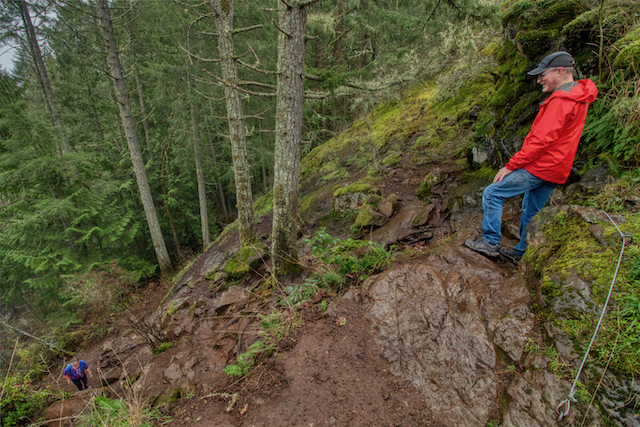
The steepest section of the climb. Some aids have been placed to make it safer
The Hike
The trail begins at the parking area below the dam at the Humback Reservoir. Mount Wells provides a buffer to the Greater Victoria Water Supply Area, helping to protect the region’s supply of drinking water. The Humpback Reservoir at the base of Mount Wells was once part of the water supply system for Victoria residents. In fact, you will cross the old flow line and follow it for a short distance as you begin the Summit Trail.
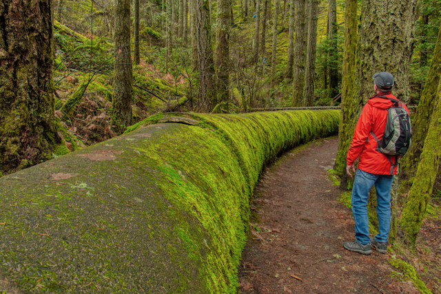
Passing by a section of the old Victoria water supply pipeline
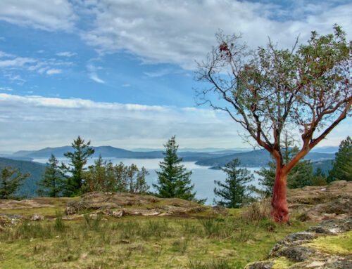
The trail follows through Douglas-fir and cedar forest, climbing up through Garry oak ecosystems as you gain elevation. The trail finally opens up on rocky smooth rocky outcrops which are dotted with arbutus trees, hairy manzanita.
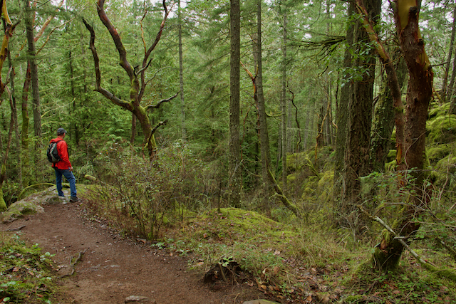
Climbing through 2nd growth Douglas Fir forest
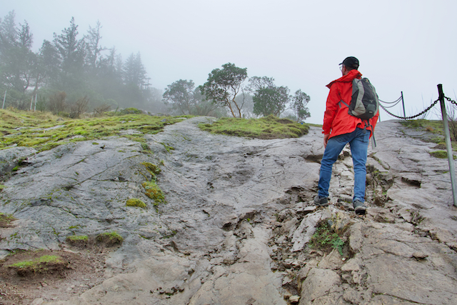
These smooth rocky sections nearing the summit can be quite treacherous when wet!
In the spring, native wildflowers such as camas, shooting star and satin flower carpet the slopes. It is important to stay on the trail to protect this fragile habitat. Even if wildflowers are not visible, walking off trail can damage bulbs that lie dormant under thin soils and will also damage the fragile mosses that cover a lot of these rocky areas.
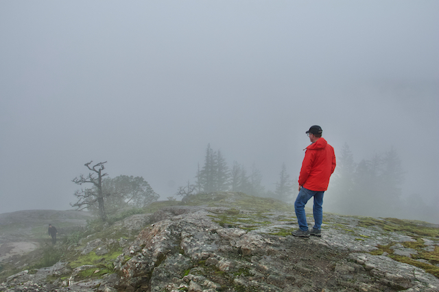
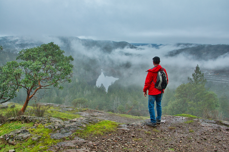
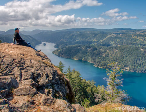
On the summit and in the clouds on this winter day’s climb
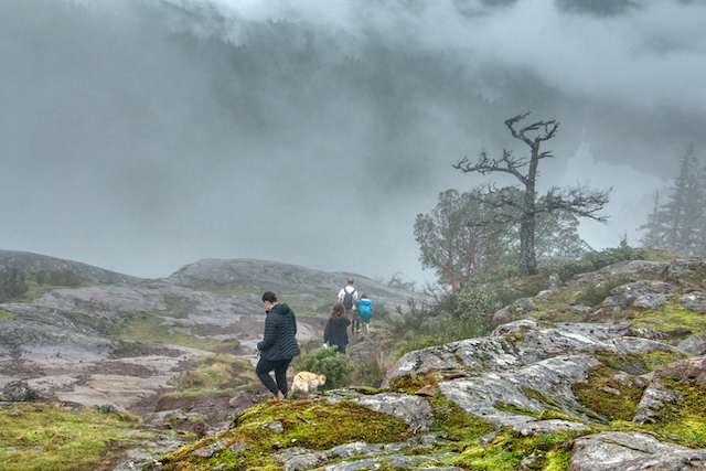
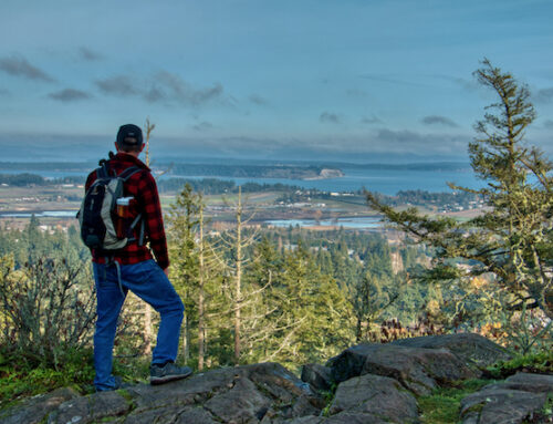
A group heading off the summit
The total hike is about 3 km (1.86 mi) and will take approximately 2 hours give or take.
Trail Map
Click this link for the CRD’s PDF Trail Map of Mount Wells
Amenities
At the parking lot there is an information kiosk and a pit toilet.
How to Get There
Follow the Trans-Canada Highway from Victoria, and turn left on West Shore Parkway. Turn right on Amy Road and left on Sooke Lake Road. Turn left on Humpback Road. At the intersection with Irwin Road, stay right. Follow Humpback Road to the park entrance on the right.
Allow approximately 30 minutes driving time from Victoria.
This is also the parking area for access to the Sooke Hills Wilderness Regional Park
More Pictures
For more images of the hike up Mount Wells or to purchase images from this website, click this link: Mount Wells Regional Park
More Adventures
For more hiking & paddling adventures in and around Vancouver Island & BC check out our sister website: Ourhomehas6wheels.com
Leave A Comment