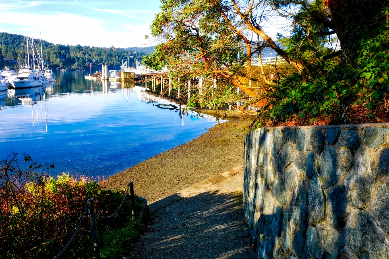
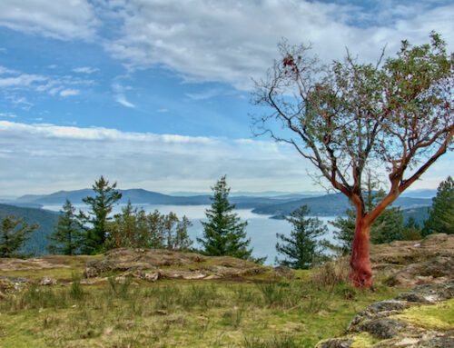
Tod Inlet in Gowlland Tod Provincial Park
One of our favourite spots in Victoria is tucked in behind Butchart Gardens where thousands of people visit every year, but have no idea that this hidden gem is so close by! Part of the reason is that this beautiful tree-lined inlet is only accessible by boat or by a walking trail. The walk is shore, only taking about 20 minutes to walk down to the inlet. Tod Inlet is part of Gowlland Tod Provincial Park which protects a significant part of the Gowlland Range and Tod Inlet and is one of the last remaining natural areas in Greater Victoria.
The History
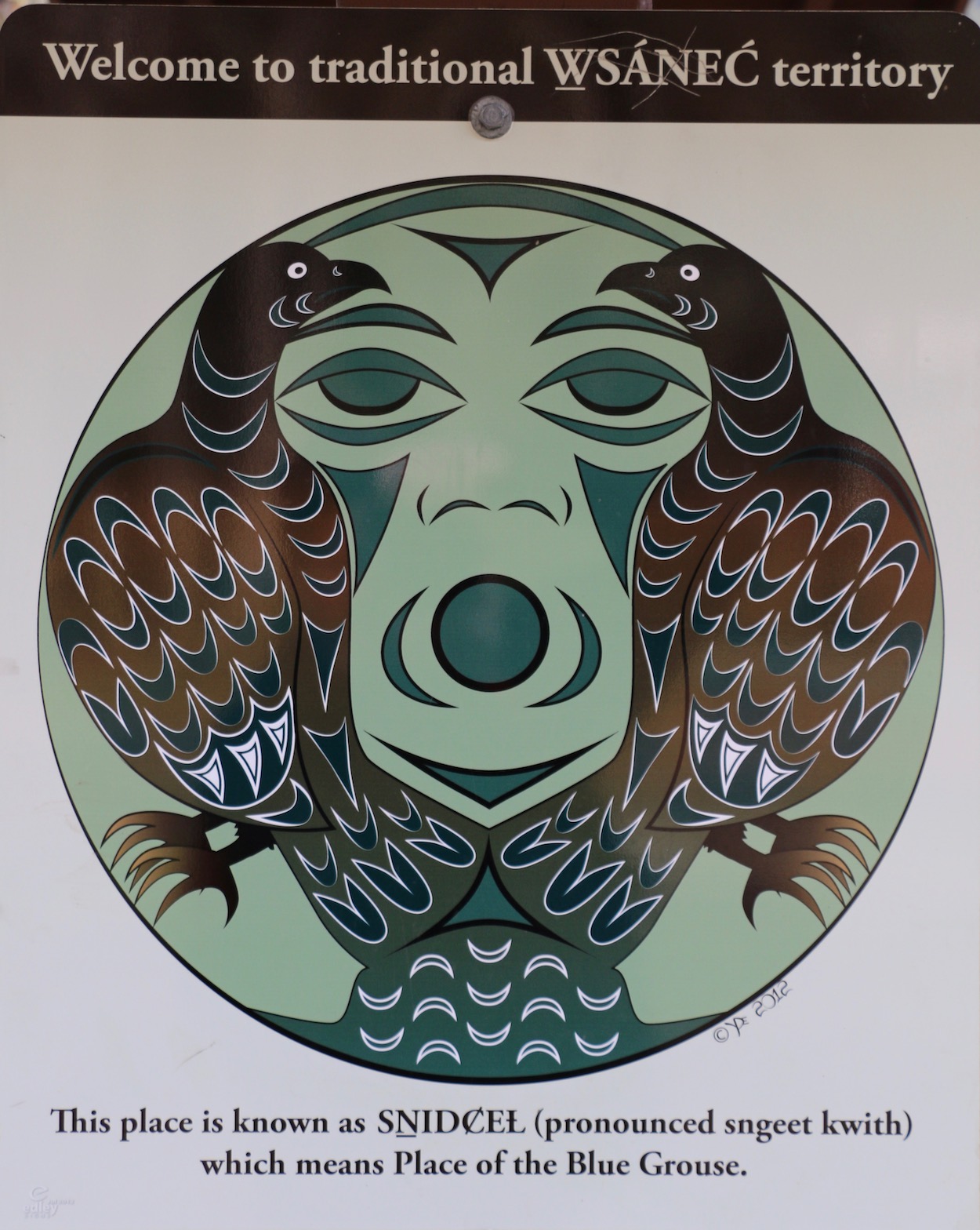 Tod Inlet is a historically significant area as it was a traditional place used by the W̱SÁNEĆ (Saanich) First Nation. It was called SṈIDȻEȽ, (pronounced ‘sneed-kwith’) which means, “place of the Blue Grouse”, a symbol meaning the land was plentiful. This was an important area for gathering edible and medicinal plants and building materials. Culturally modified trees (Western Red Cedar) can be seen along edges of the trail.
Limestone was discovered here in the late 1800’s and started the industrial use of the area. Later, this became the foundation for Butchart Gardens created in the remnants of the exhausted limestone quarry. The Butchart family purchased the land in the early 1900s and established the Vancouver Portland Cement Company. Quarrying here continued until 1912 until the limestone was exhausted and the plant was moved to Bamberton across Saanich Inlet.
The industry brought settlers to the area and the construction of shanty towns. There is lots of evidence of these people’s lives scattered throughout the area, which included a large community of Chinese, Sikh & European immigrants. Cement foundations and discarded bricks along the banks of the inlet are very prominent features and there is an old garbage dump hidden in the forest along Tod Creek with the remains of pottery, old glass bottles, tin cans & boots.
As you begin walking the trail you will see an old dam on Tod Creek and remains of other industrial structures further along the trail.
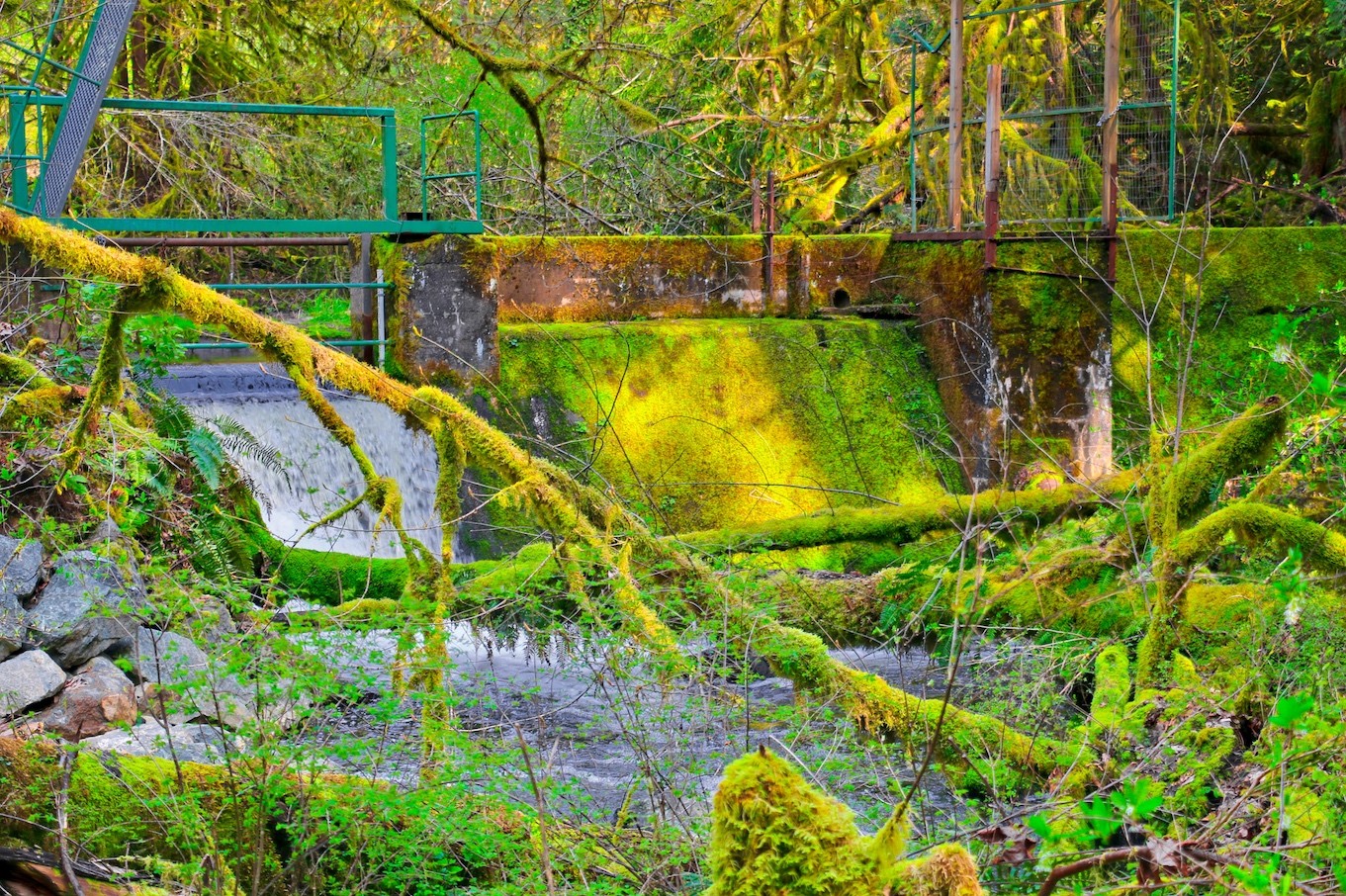
Tod Creek Dam (built in 1904 or 1905)
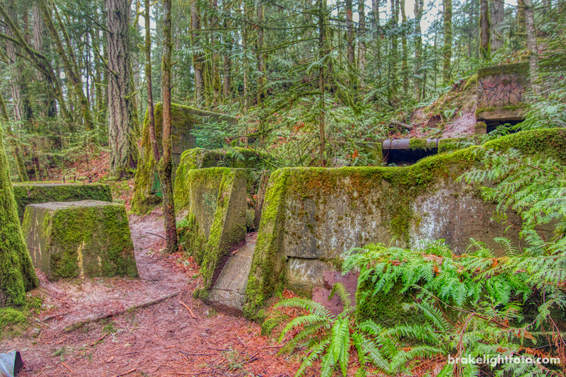
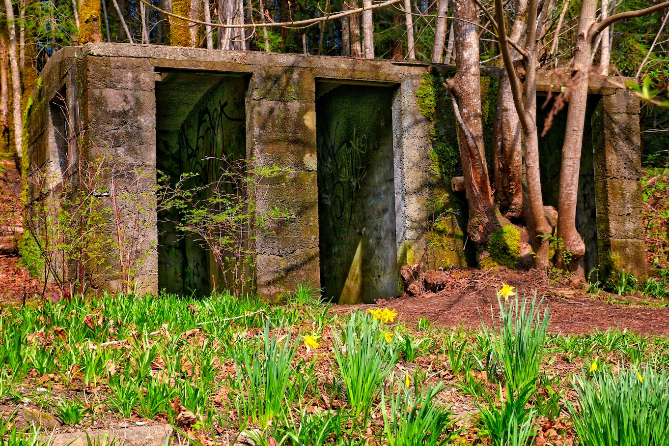
Clay Mill Ruins along the main path from Wallace Dr
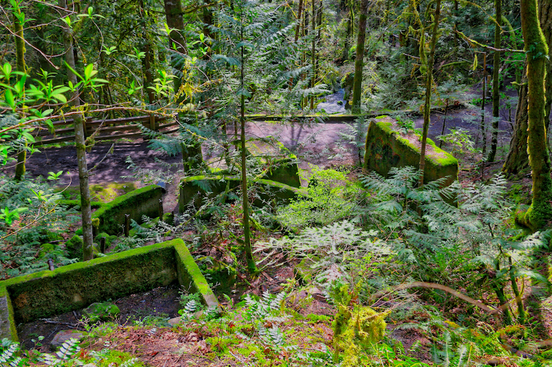
The Clay Mill Ruins viewed from the old rail line
Hiking
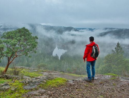
Walking access begins off Wallace drive near Benvenuto Ave and follows Tod Creek down through lush rain forest on the way to the inlet. Along the way you will see many varieties of plants and trees including lots of trilliums and fawn lillies in the spring.
Tod Creek follows a good part of the trail with lots of interesting small waterfalls and rapids, particularly nice in the winter and spring. You can take a side trail before you get to the inlet and walk down some steep stairs to the mouth of the estuary. Closer to the inlet you will see lots of old building foundations and in the distance a huge old smoke stack which was part of the cement factory.
Tod Inlet Ruins – an old store house

Trillium and Old Glass Bottles
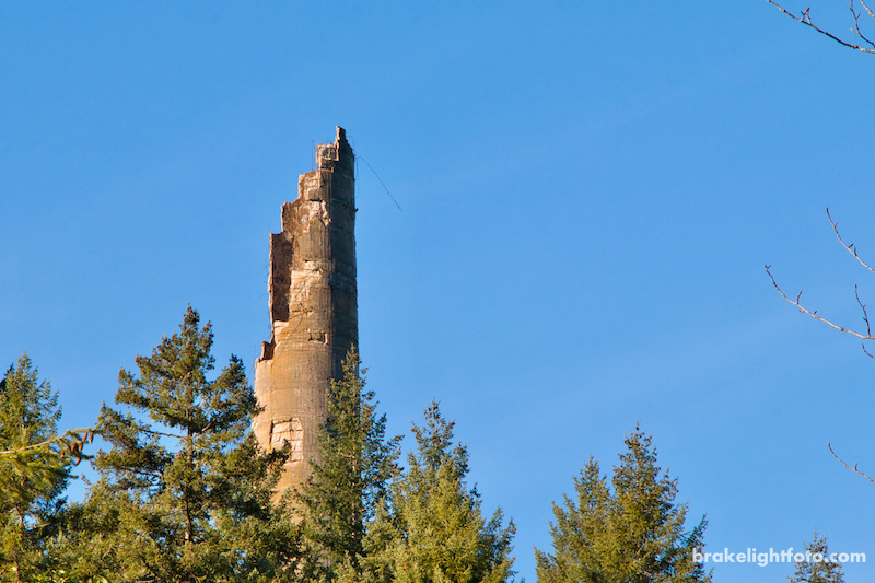
The smoke stack is all that remains of the cement plant (the top crumpled in 2019)
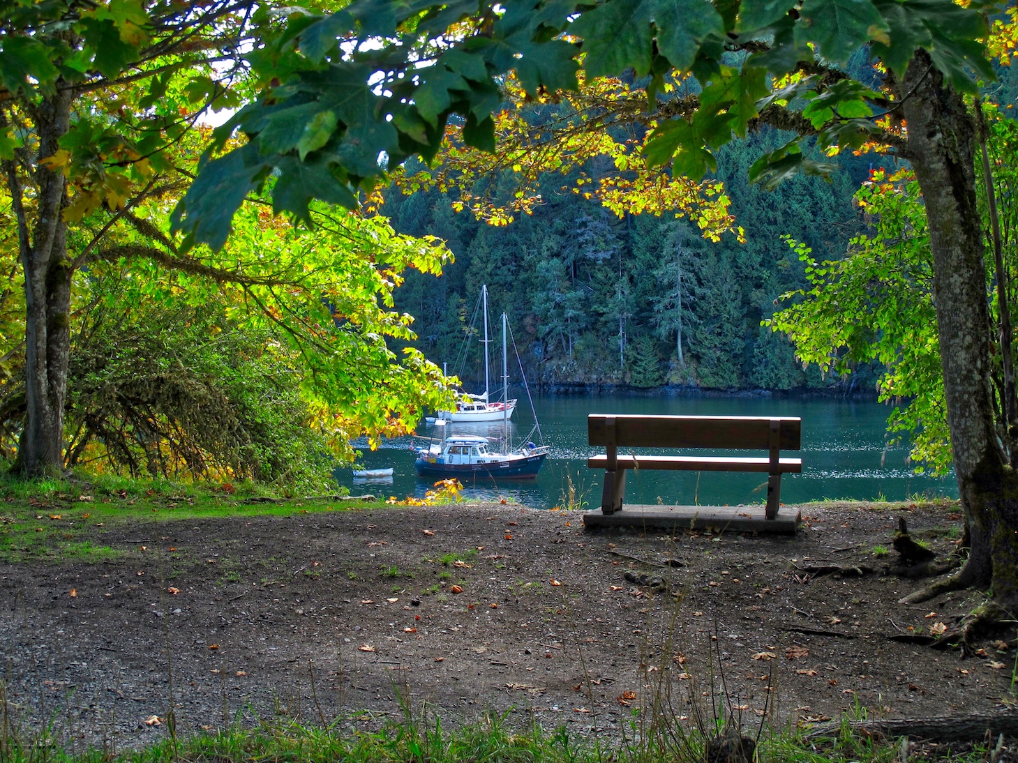
Tod Inlet is a very peaceful place to come and just sit or have a picnic
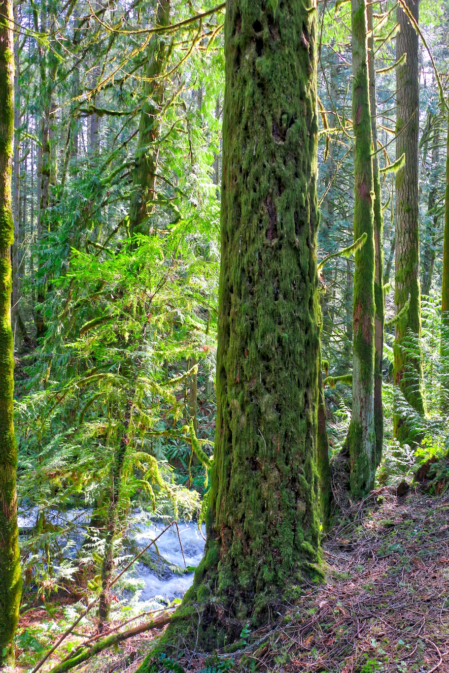
The trails winds through lush forest and on the way to the inlet.
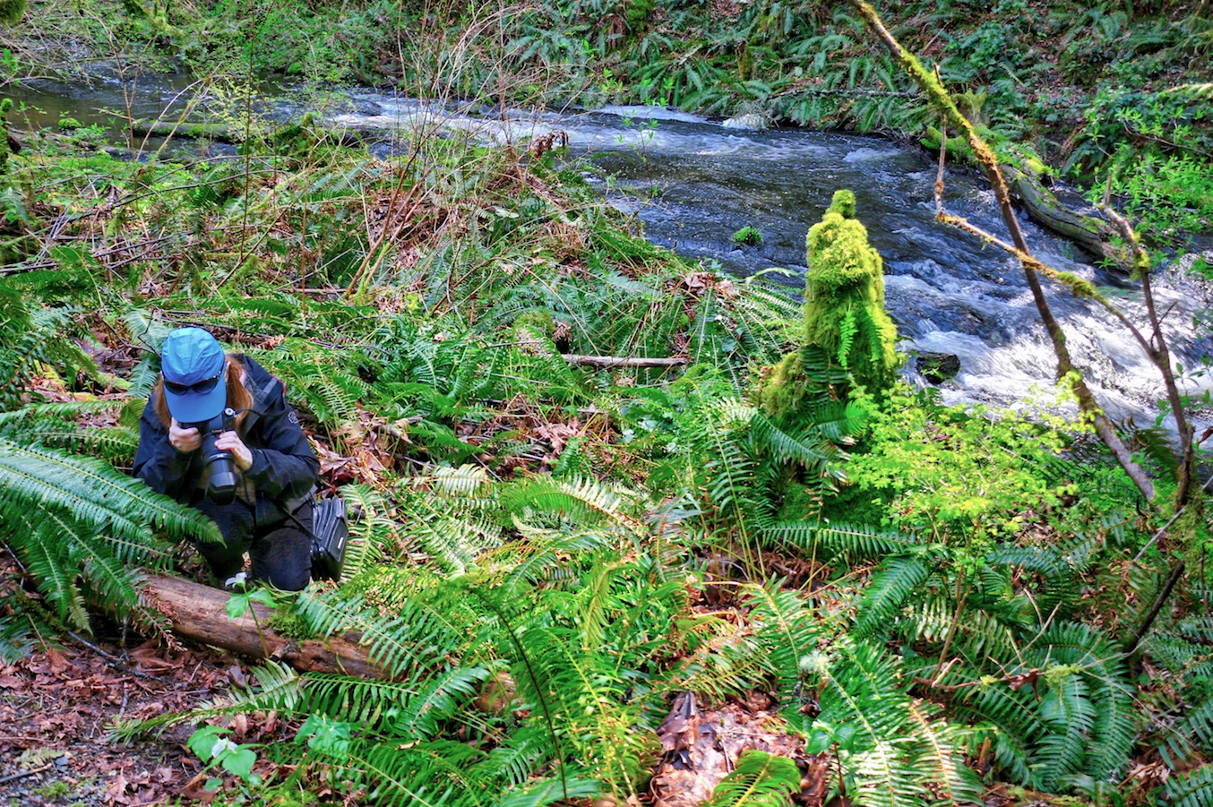
The Tod Inlet hike is a photographer’s paradise
Paddling & Boat Tours
If you are interested in paddling into Tod Inlet it is an ideal trip for beginners as the waters here and the launch at Brentwood Bay are very sheltered. The total route there and back is only about 5 kms/3.1 miles.
The put in for the paddle is at Verdier Park next to the Brentwood Bay Spa & Lodge. Once on the water paddle out past the docks. Directly in front of you, across the bay, is Willis Point. Tod Inlet runs along this land mass to the left. You can bear left and paddle directly towards the inlet skirting Daphne Island or you can paddle along the eastern and southern shore of Brentwood Bay following it along to the inlet. Brentwood Bay can be quite busy with boat traffic, so be careful and keep a careful watch while paddling.
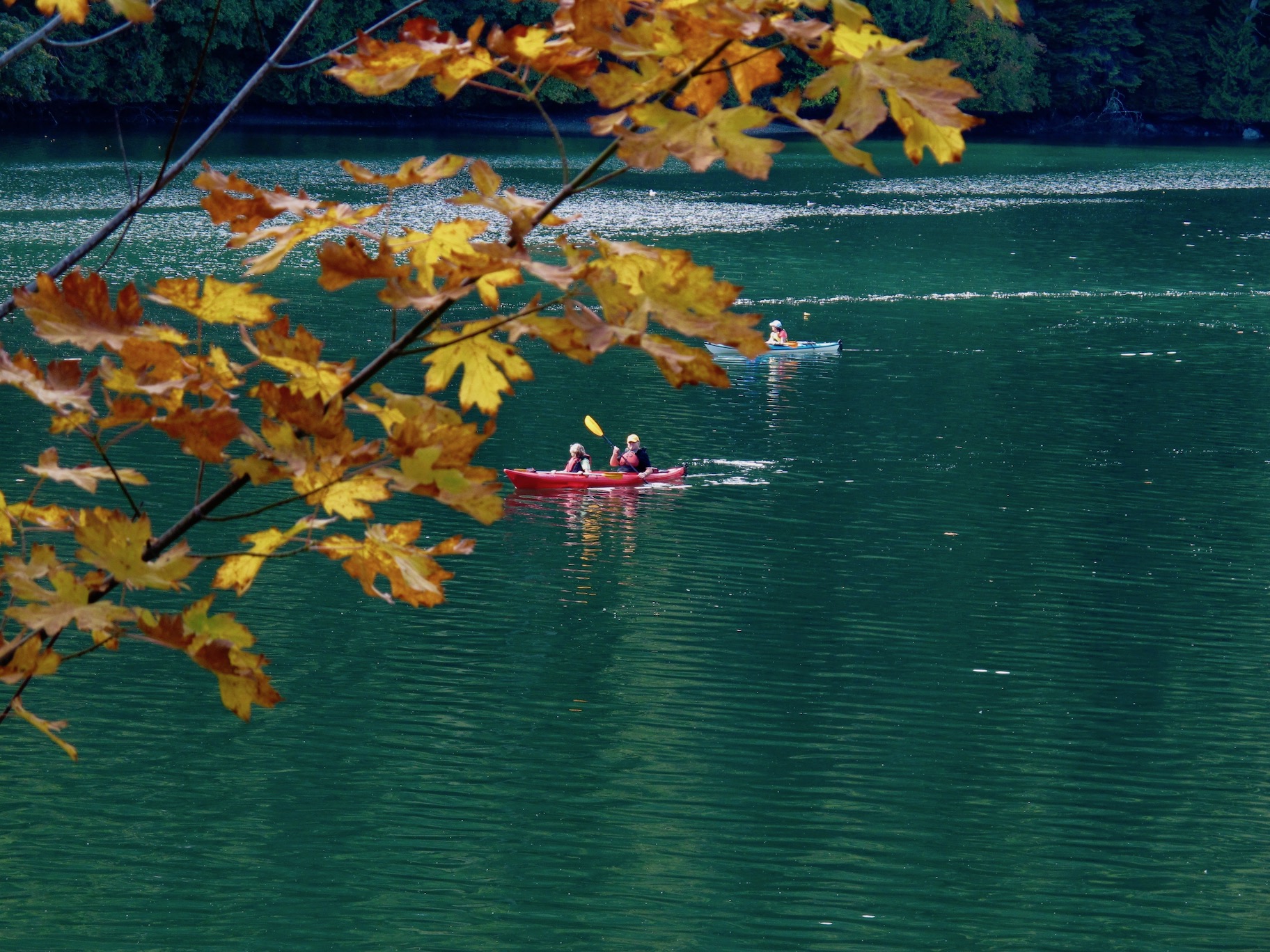
Kayaking the sheltered waters of Tod Inlet
As you paddle towards the inlet you will pass Butchart Cove on your left. The dock you see in this cove belongs to Butchart Gardens and their Tod Inlet boat tours leave from here, which is another great way to see the inlet. For more information click this link: Butchart Gardens Boat Tours.
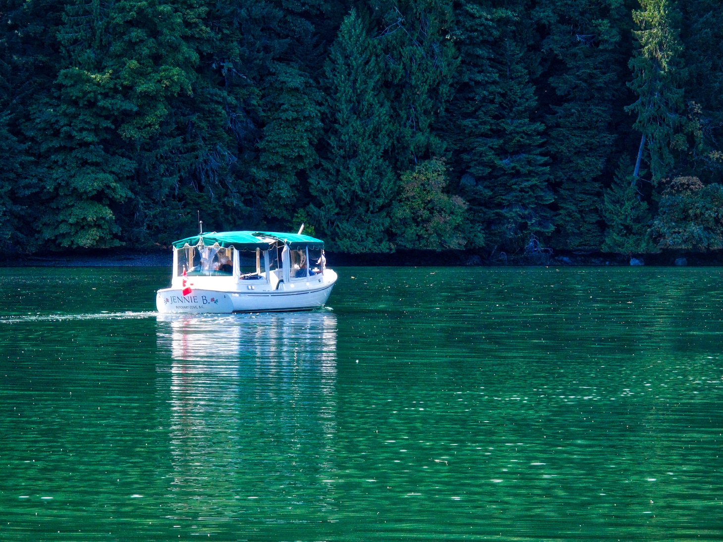
The Butchart Gardens Tour Boat on Tod Inlet
During summer months, Tod Inlet is a popular destination for boaters on Saturday nights when Butchart Gardens puts on their evening fireworks demonstration. If you decide to come out for this event make sure to bring a head lamp, and better yet, a full 360º visible navigation light as you will be paddling back after dark and will be jockeying for position with a lot of other boaters.
Where to Launch
You will launch from a small park at the end of Verdier Ave by the Brentwood Bay BC Ferries terminal. There is a driveway here where you can stop and unload boats and equipment and there is a public washroom. A paved walkway leads down to a gravel beach for an easy launch. You will have to move your vehicle and find a place on the street to park. Parking can be a bit of a problem as there are limited spaces. You can also rent kayaks, standup paddle boards and canoes from Pacifica Paddle Sports or from the Brentwood Bay Marina and leave directly from their facilities, both of which are right on the water.
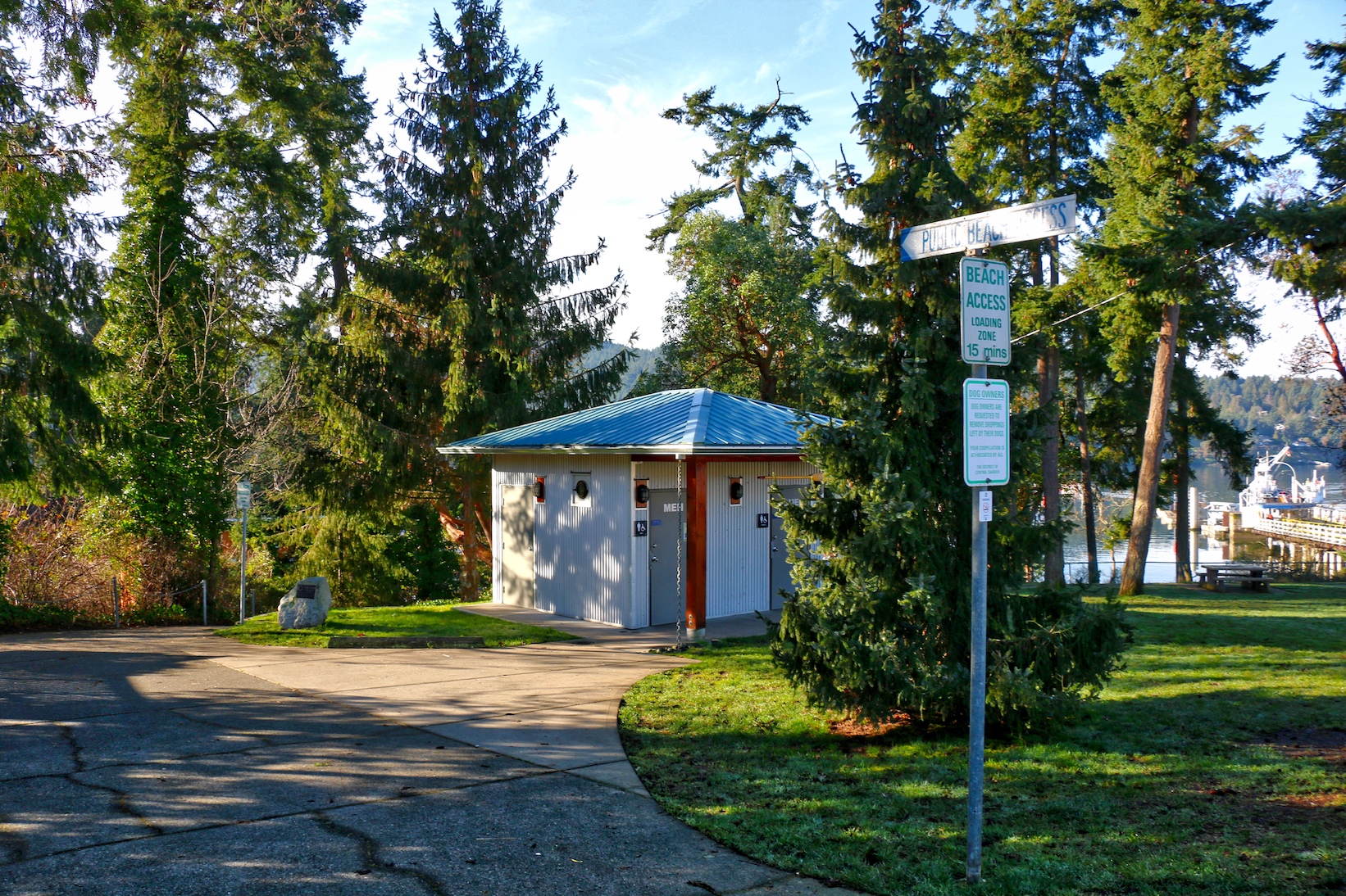
Boat loading area and public washroom
Public beach access and paddle craft launch at Brentwood Bay
The Nature
Depending on the time of year, you can often see lots of jellyfish in the inlet; and along the shore there are lots of sea stars and sun stars. In the trees along the shore or flying overhead you will often see eagles and great blue herons.
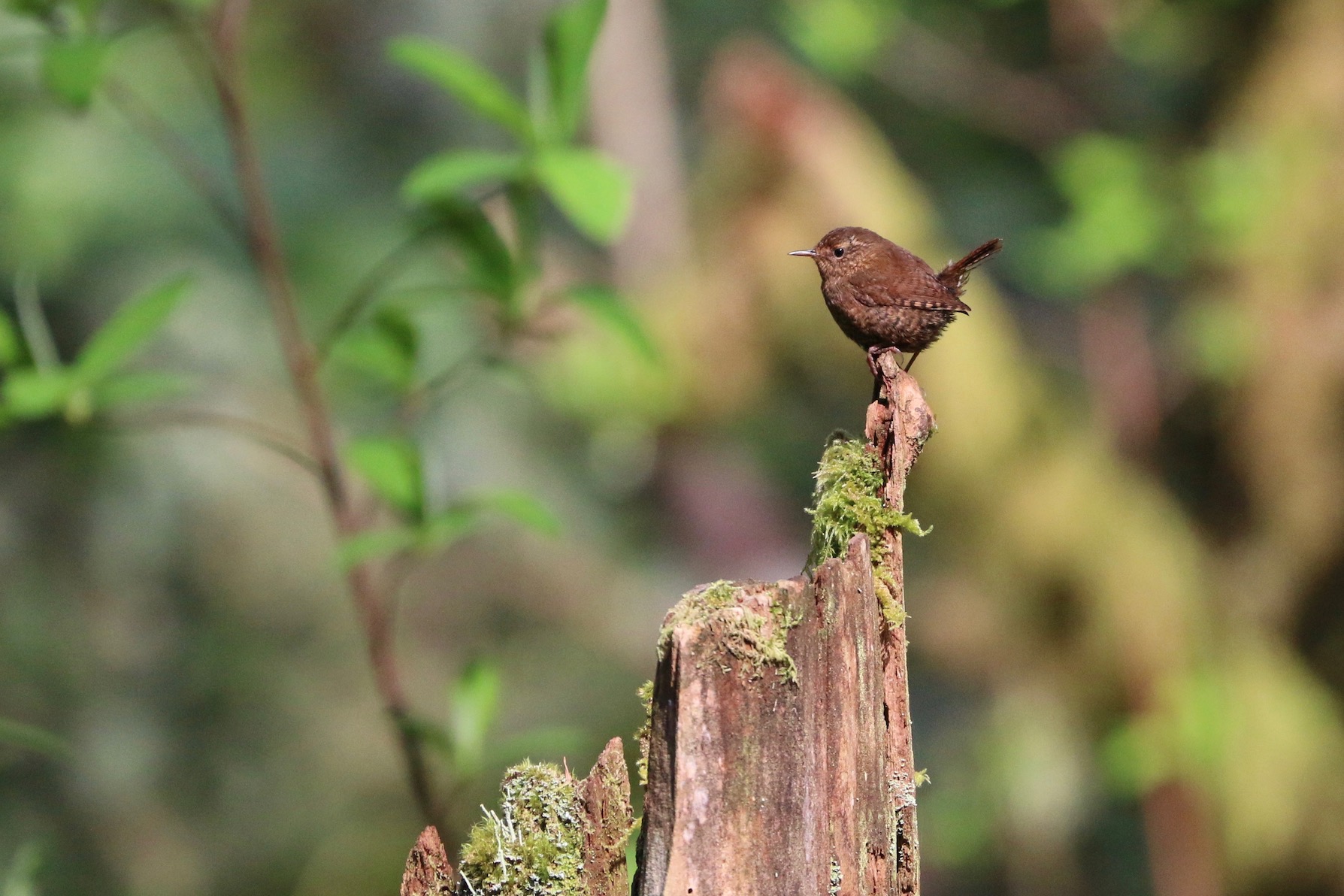
Pacific Wren (formerly Winter Wren)
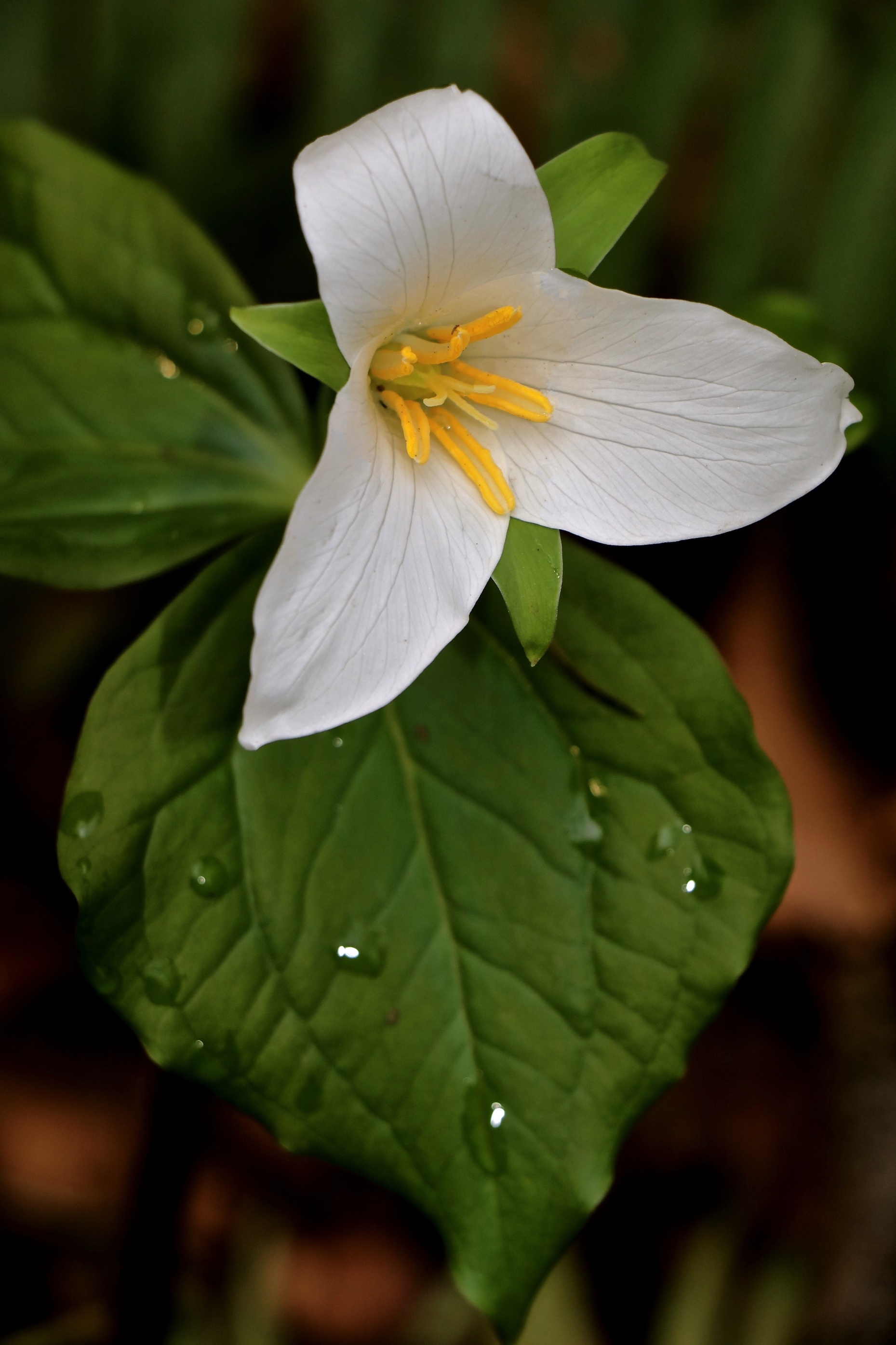
Trilliums found in the spring
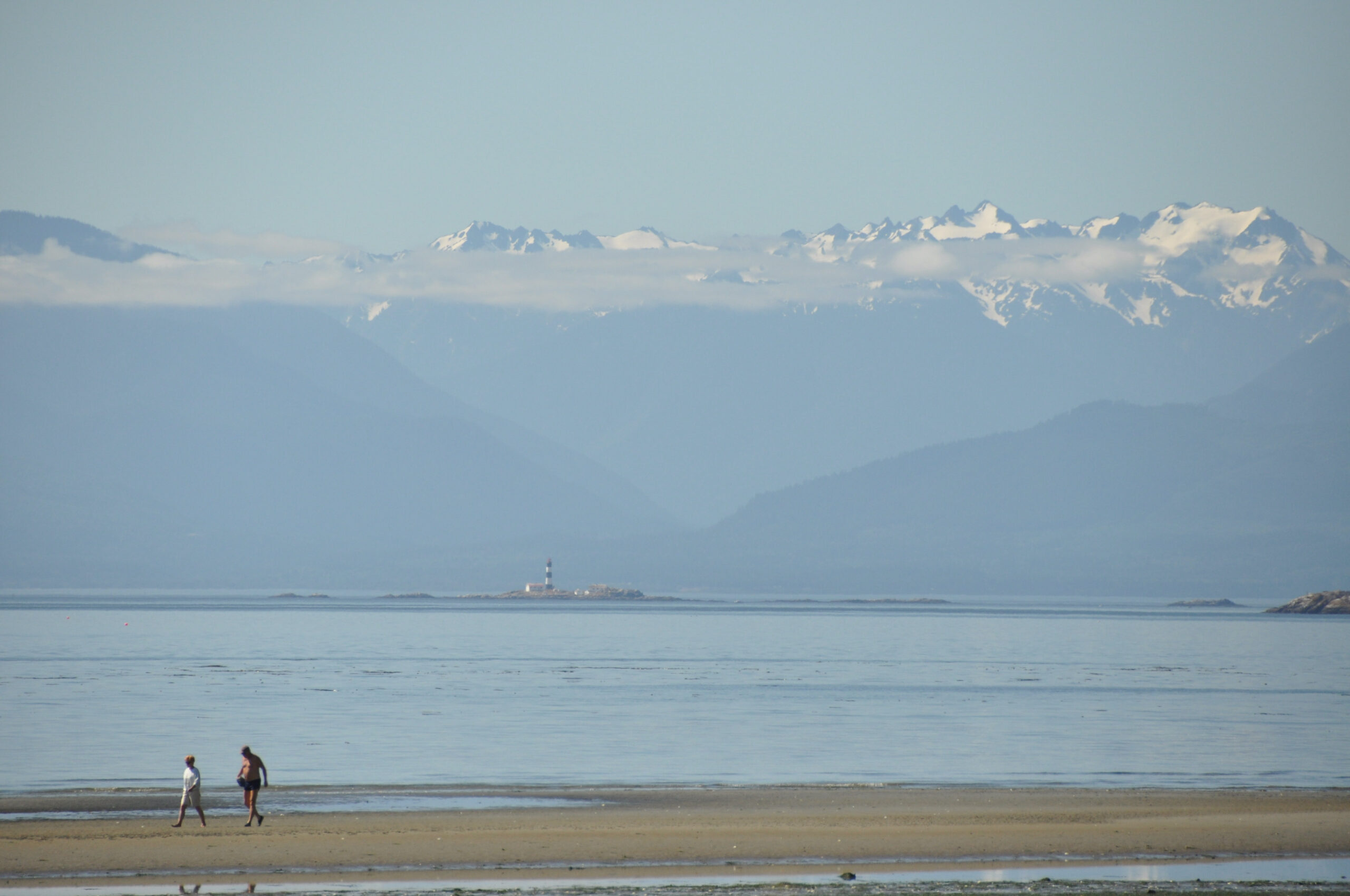
The trees covered slopes surrounding Tod Inlet are part of Gowlland Tod Provincial Park. This park encompasses nearly the entire east side of Saanich Inlet, stretching from Goldstream all the way to Brentwood Bay. The trees along the shore to the north hide Buchart Gardens.
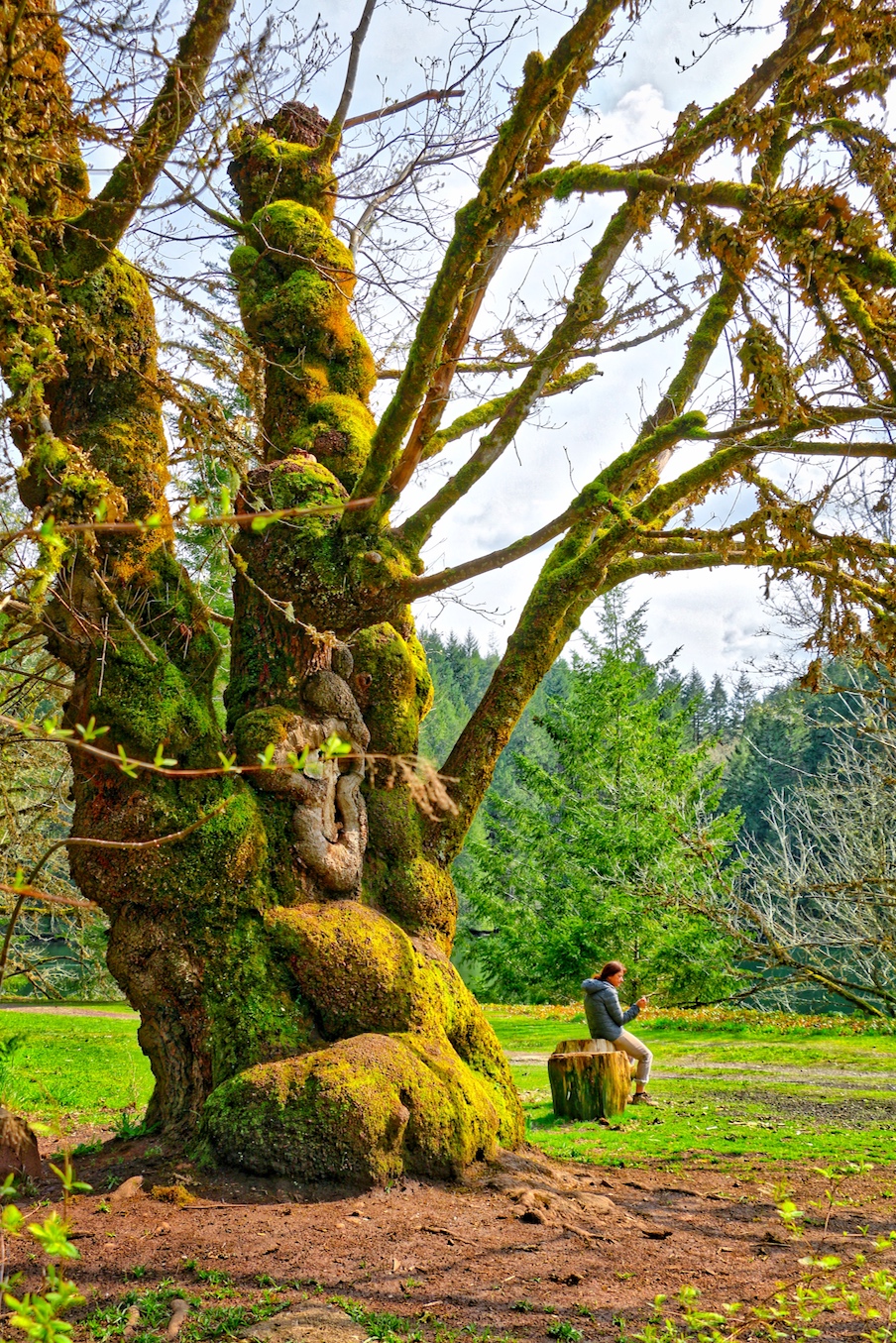
Giant Maple at Tod Inlet
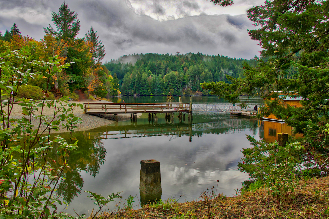
Tod Inlet
Along the shore you will see the remain of the piers of the old cement plant loading docks. You will notice lots of birdhouse’s attached to the pilings, some them are model RV’s! If you are here during the summer you should see lots of Purple Martins, a large relative of swallows, who call these home. They have recently begun to restore the park and have brought in a load of gravel and sand making beach access much more pleasant.
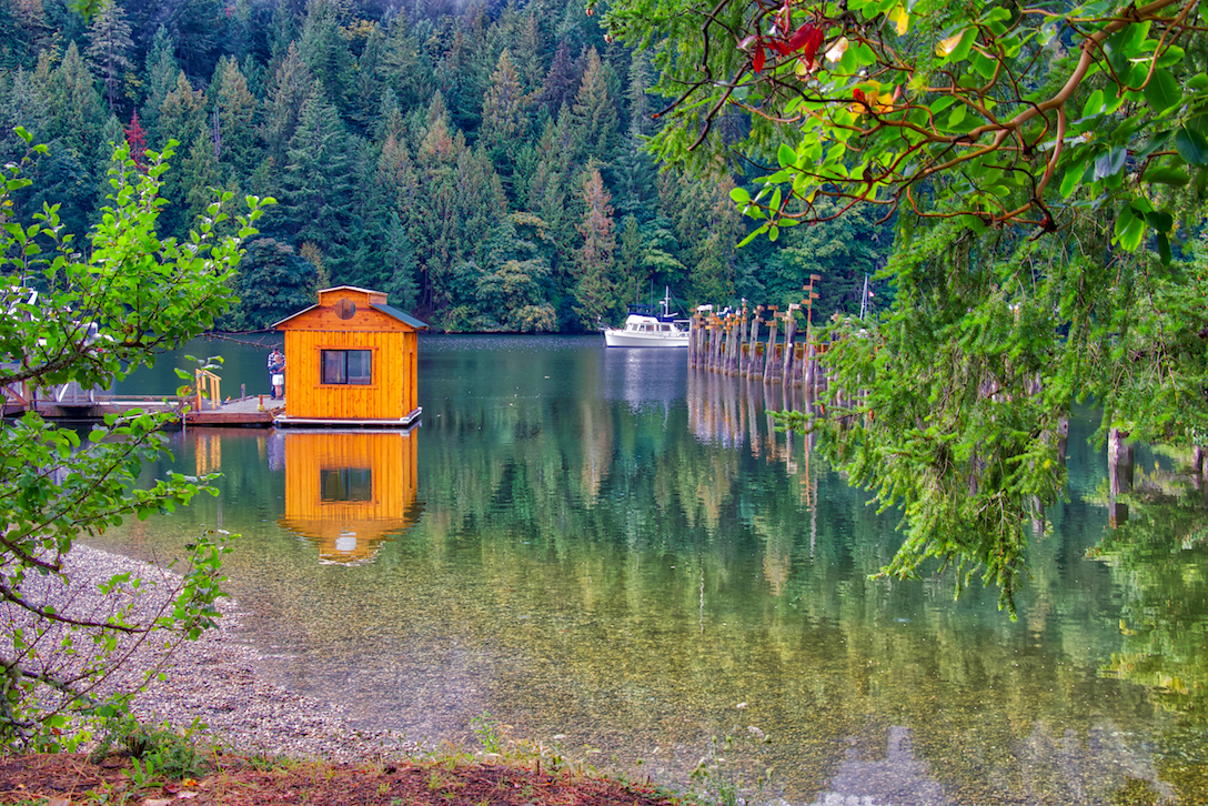
The Tod Inlet Boat House & Dock
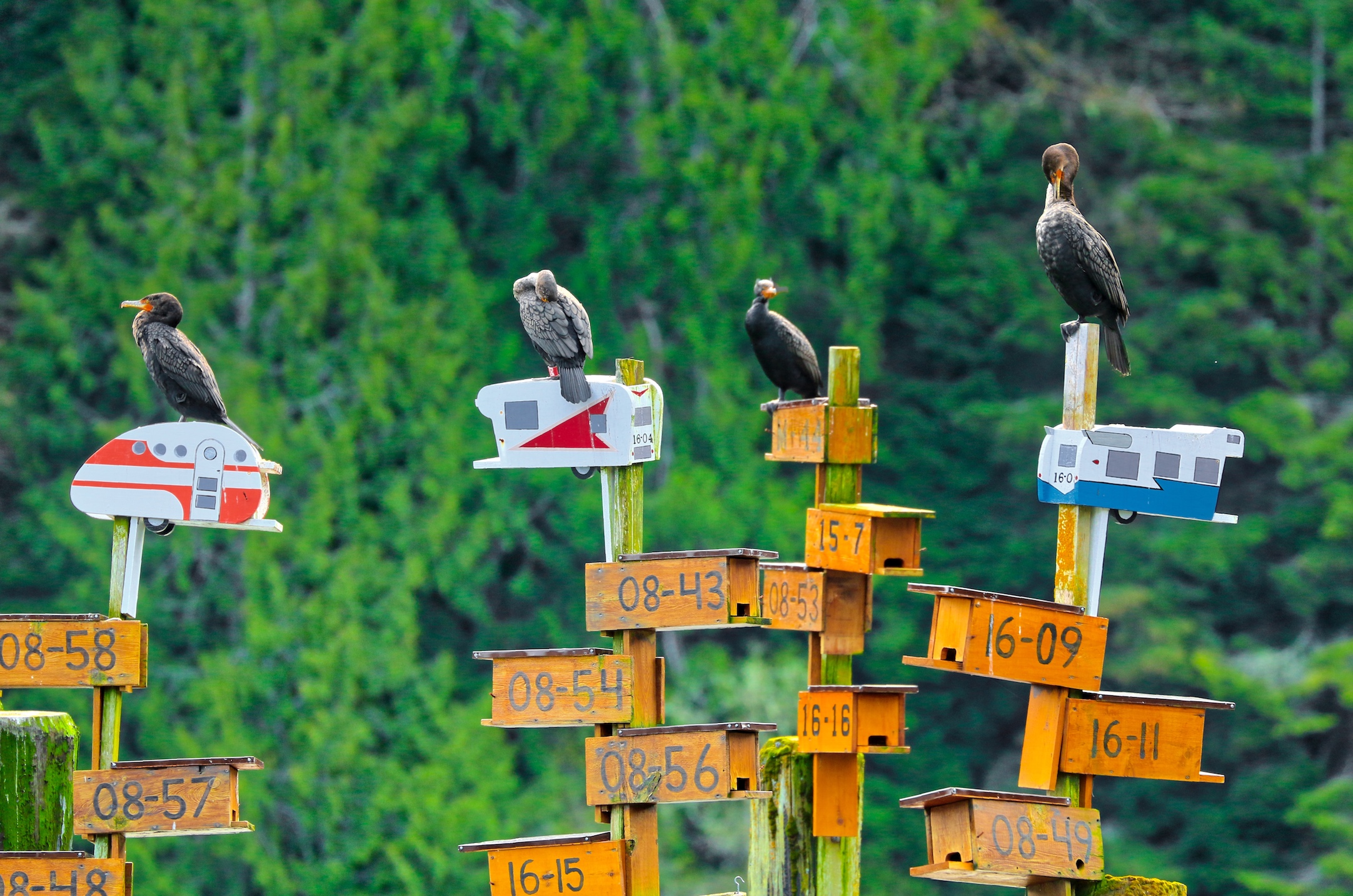
Cormorants sitting on Purple Martin Bird Houses
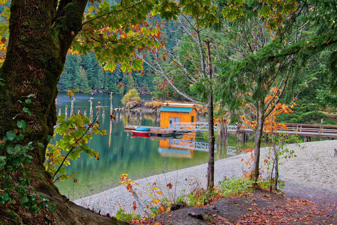
A gravel and sand beach have been added as part of park improvements
Ammenities
Just back from the water at the inlet, back against the trees, there are pit toilets, and there are some picnic tables here, so bring a lunch and enjoy the serenity of this beautiful inlet.
If You’re Interested in More History of Tod Inlet
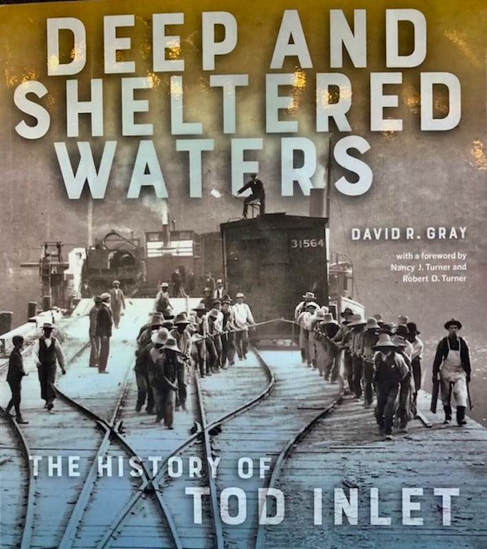
For many years I have wondered about the history of Tod Inlet, what the ruins were, who worked here, who lived here? There is an excellent book that has recently been published, “Deep and Sheltered Waters, The History of Tod Inlet by David R. Gray and published by the Royal BC Museum. It is an excellent and very interesting read that covers the history of Tod Inlet from time the W̱SÁNEĆ (Saanich) people lived and hunted here, to the days of the first white settlers, the establishment of the cement plant, and right up to modern times and the establishment of the park. You can find it here at this link: Deep and Sheltered Waters
 How to Get There
Driving Directions
To get here from downtown Victoria, drive north on Blanshard Street which becomes Highway #17 (or the Pat Bay Highway) as you leave the city. Take Exit #11 at Royal Oak Drive. Turn left and cross over the highway following Royal Oak Drive for about 1 km, turn right onto West Saanich Road. Follow West Saanich Road for about 5.5km and turn left onto Wallace Drive. Drive approximately 3km. There isn’t much signage marking the trail head, so it’s easy to miss but you will usually see cars parked along the road to your left. If you get to the stop sign at Benvenuto Avenue you have missed it. Turn around and it should be about 700m back along Wallace on your right.
Map
More Images
To see more images or purchase photos for websites, prints etc, click this link: Tod Inlet

[…] grief storm that followed, I found calm as we anchored in secluded anchorages such as B.C.’s Tod Inlet. I could reflect, cry, remember and grieve surrounded by beauty and peace. And sitting there […]
[…] If you’re planning on going out more than once, you may want to consider buying rather than renting. Getting your own kayak or canoe (insert How to buy a canoe Blog Post from May 2019) and gear is often a worthwhile investment as rental fees can quickly add up. You can launch basically anywhere there’s water, but we always love Gorge Waterway, Langford Lake, and Tod Inlet. […]
Having lived in Tod Inlet during late 50’s and Earl 60’s and having Butchart Gardens as our ‘playground’ brings back so many wonderful memories, and stories. Now in my late 80’s I have documented my time that our family lived in, and worked from, this Hidden Gem. I lived the experience and history I knew the people and the Chinese gardeners of Butchart Gardens. What I didn’t realize is that our homes were termed as ‘shanty towns’ by the person who wrote the history of Tod Inlet!? And, to which I take great exception to.
Hi Olive, The term ‘shanty town’ sounds derogatory but I believe in this context it simply meant: “While most shanty towns begin as precarious establishments haphazardly thrown together without basic social and civil services, over time, some have undergone a certain amount of development.” (from Wikipedia) So in this context I believe it was talking about the informal and not structured buildings and establishments that began after 1912 … but by the time you were there it was probably more of a ‘formal’ type of ‘town’. It must have been a wonderful childhood! We love to wander around and picture what beauty there must have been back in the day. Thanks for your comment.
[…] of our sailing was done in around Saanich Inlet, all the way from Finlayson Arm up to Cowichan Bay. Todd Inlet and Mill Bay Marina (the best marina I have ever been lucky enough to frequent) were our two main […]
[…] Click Here to Visit Tod Inlet’s Website […]
******Does anyone know if the water is safe to swim in, at Todd Inlet, the sandy pebble beach area, off of Wallace Drive after the shooting range?
There’s a small beach at the end of the trail at Tod Inlet. It’s fine for swimming. I’m not sure what beach you’re referring to as I don’t know of any shooting range in the area.
[…] Range near Victoria on Southern Vancouver Island, BC. It also includes a significant portion along Tod Inlet, running from Wallace Dr down to the location of the old cement plant on the north side and the […]