Exploring Gowlland Tod Provincial Park
Gowlland Tod Provincial Park provides some amazing opportunities for hiking and immersing yourself in nature. There are more than 25 kms of trails with varying in degree of difficulty that offer spectacular views, as well as the chance to view animals in their natural environment. In spring and early summer, the moss-covered rocky knolls come alive with a carpets of colourful, vibrant wildflowers.
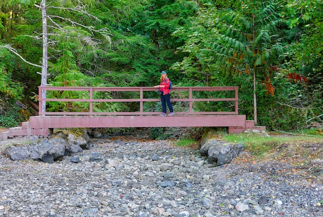
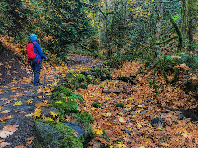
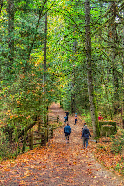
Bridge across the stream at Mackenzie Bight
Gowlland Tod protects a significant part of the Gowlland Range, one of the last remaining natural areas in Greater Victoria, and a significant portion Tod Inlet. The Gowlland Range is a particularly rich area of biodiversity, with more than 150 individual animal and plant species identified. The protected area preserves a rare, dry coastal Douglas fir habitat that features grassy meadows, rocky knolls and old-growth forest. The park also protects a significant wetland.
There are 3 main access points to Gowlland Tod; Tod Inlet, Mackenzie Bight and Caleb Pike. The Tod Inlet access is located near Brentwood Bay, off Wallace Drive. The Mackenzie Bight access is located off Ross Durrance Road near Willis Point Road. The Caleb Pike access is on Caleb Pike Road, in Langford. Mackenzie Bight and Tod Inlet can also be accessed by boat by launching from nearby Brentwood Bay.
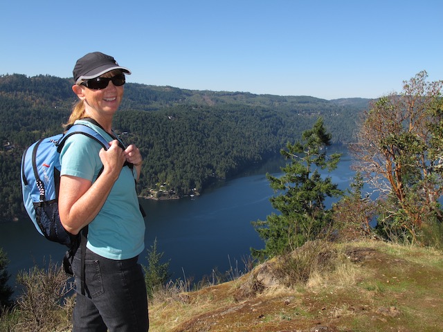
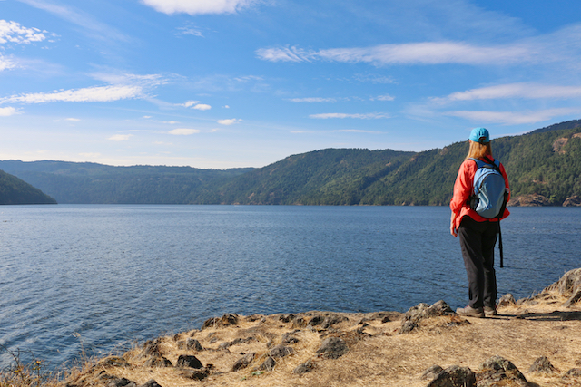
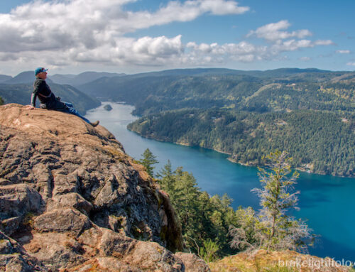
Amazing views of Finlayson Arm from the trail to Jocelyn Hill
Another popular hike – accessible from the parking lot for McKenzie Bight – is the trail up to Mt. Work. See post on Mt. Work for details.
Activities Available In Gowlland Tod
Hiking
There are more than 25 kilometres of trails varying in degree of difficulty in Gowlland Tod Provincial Park.
Difficulty: Easy to difficult. Trails can be done in sections ranging from 1 – 2 hours to 3 – 5 hours.
Be prepared! A lot of this trail is wilderness. Carry water and wear sturdy shoes/boots.
Caleb Pike
Those beginning at Caleb Pike lead to some stunning views from high on the ridge above Finlayson Arm. These trails can be followed all the way to Mackenzie Bight. For shorter excursions you can access the middle portion of the Gowlland Range. There is trail access to Jocelyn Hill off of Millstream Rd just up from Emma Dixon Rd.
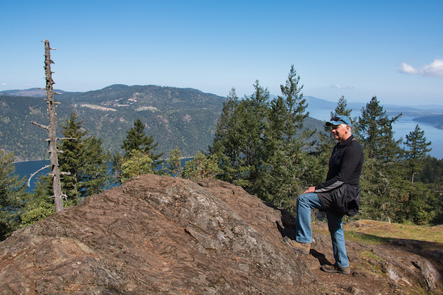
Jocelyn Hill
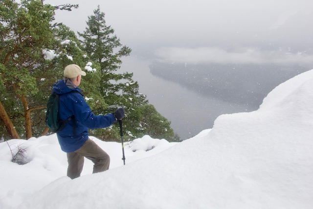
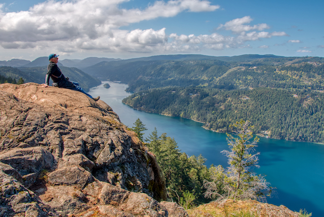
Winter Hiking on the Jocelyn Hill trail
Mckenzie Bight
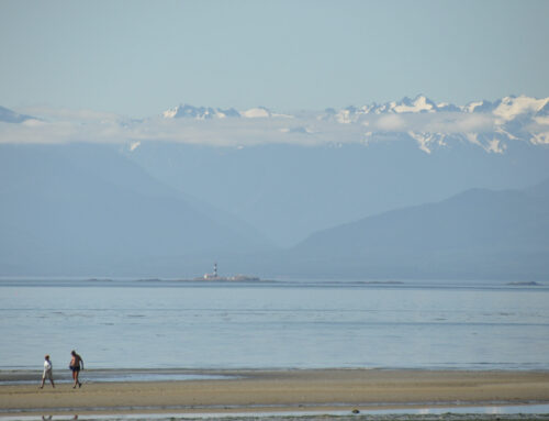
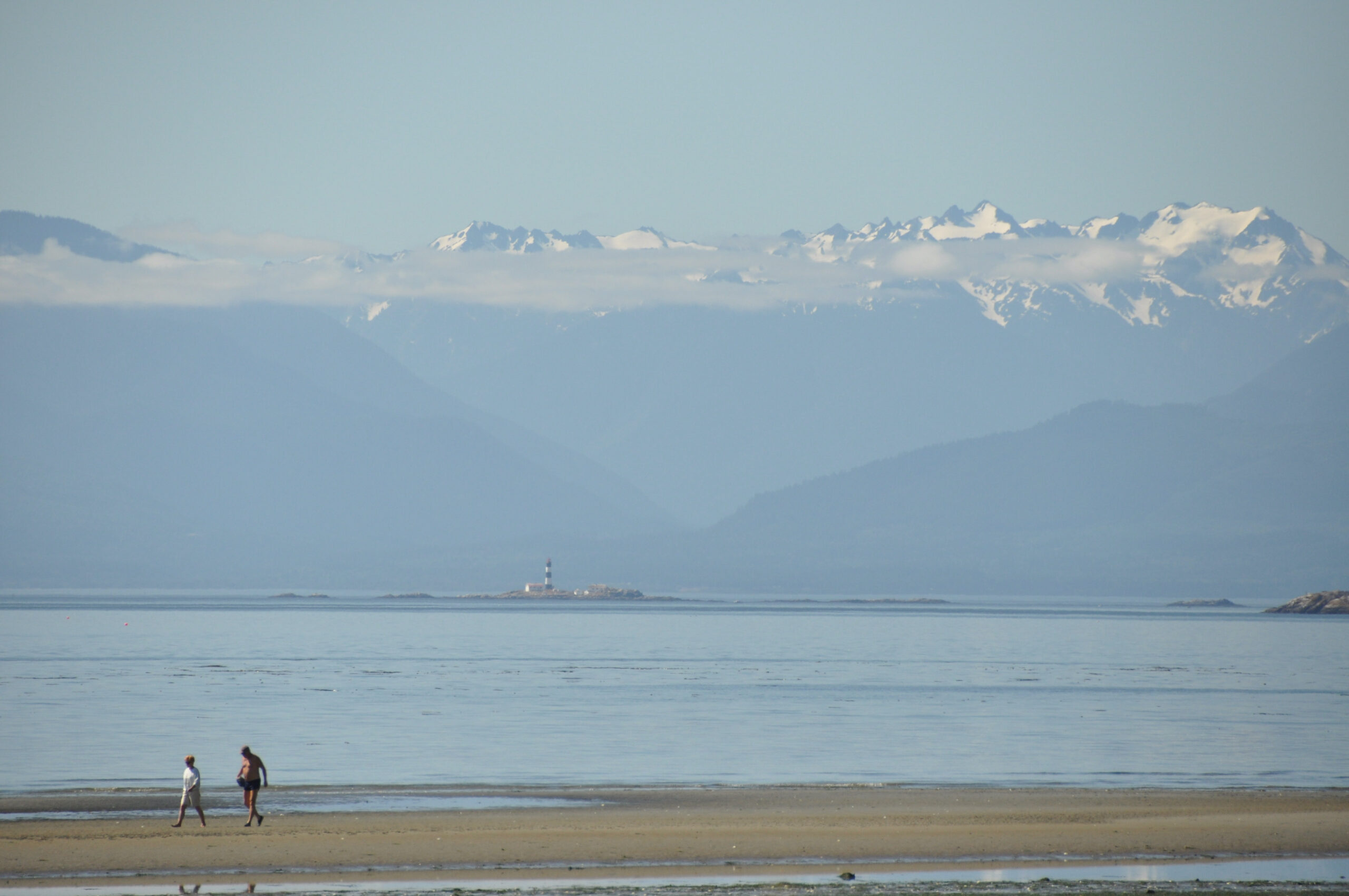
There are two trails at the Mckenzie Bight access leading down to the shores of Saanich Inlet. Here you will find a sheltered estuary with a rocky beach and other areas of rocky shoreline. It is a great spot to explore and have a picnic lunch! Either way you choose to go you will need to allow a couple of hours. The main Mackenzie Bight trail, the most direct route down, is a wide, relatively smooth gravel path but it is still fairly steep so be prepared for a continuous climb back to the top.
You can choose to go up and back the main trail or make it a circle trip, either way you will be treated to a wonderful walk through some spectacular rain forest trails!!
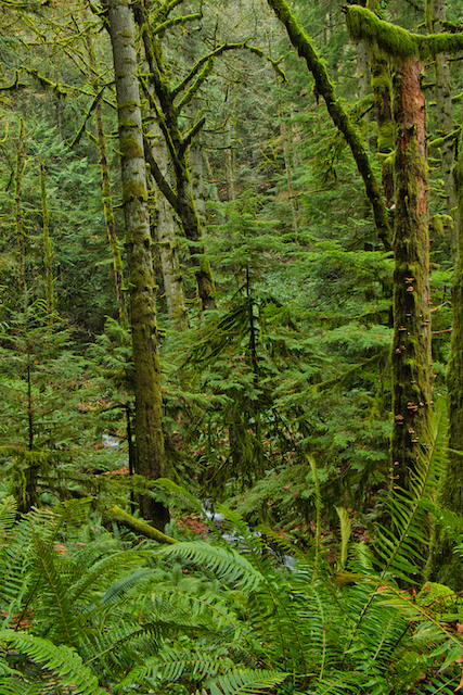
Spectacular rain forest views
The main trail to Mckenzie Bight
The Cascade Trail is a little more circuitous and is much narrower, steeper and involves some stairs. The path follows Pease Creek for a ways and there is a good view point along the way of the falls. The falls, (the Cascade View Point) are just a trickle during dry months, but can be quite spectacular if you catch them after heavy periods of rain in the fall and winter.
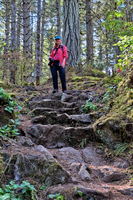
Steep stairs on the Cascade trail down to Mckenzie Bight
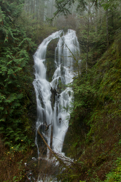
Waterfall on Pease Creek after a heavy rain
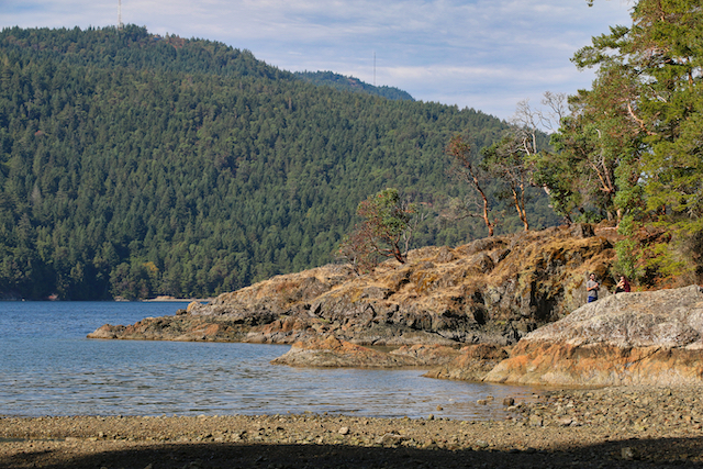
The beach at Mckenzie Bight
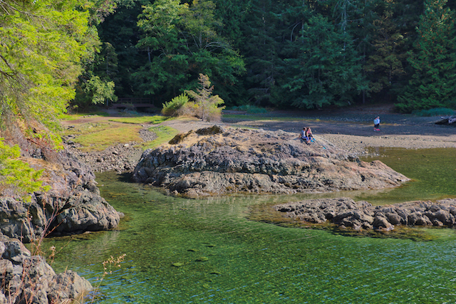
Mckenzie Bight
Great views of Saanich Inlet at McKenzie Bight
There are also trails leading south from the Mckenzie Bight parking area following the Gowlland Tod Range leading back to Jocelyn Hill and Caleb Pike. We did this entire trail one day by dropping a vehicle off at the McKenzie Bight parking area, then driving to Caleb Pike to start the hike. It is around 12 kms and roughly 5 hours with some relatively difficult sections.
Tod Inlet
The trails at Tod Inlet lead down to a beach area and dock on the inlet and the site of a former cement plant. This is an easy and beautiful walk of only about 3 kms and can be done in about an hour. For more information and history on the Tod Inlet portion of the park, check out our post Tod Inlet.. Unfortunately there are no longer any established trails connecting the Tod Inlet trails with the trails on the hills on the south side of Tod Inlet. The author did an exploratory to find where they used to connect. You can find that post here: Tod Inlet to Cole Hill.
The path to Tod Inlet
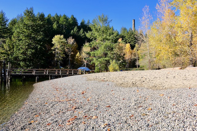
The beach at Tod Inlet
Paddling
There are opportunities for SUPing, canoeing or kayaking in Gowlland Tod. To access Tod Inlet and McKenzie Bight by water, you will have to launch at a boat launch in Brentwood Bay just behind Brentwood Bay Spa & Pub. If you are paddling in Saanich Inlet please be aware the Goldstream estuary is closed to the public. No boaters or paddlers may enter this area. Check out our articles on paddling in Saanich Inlet: Kayaking Saanich Inlet or Paddling to Tod Inlet
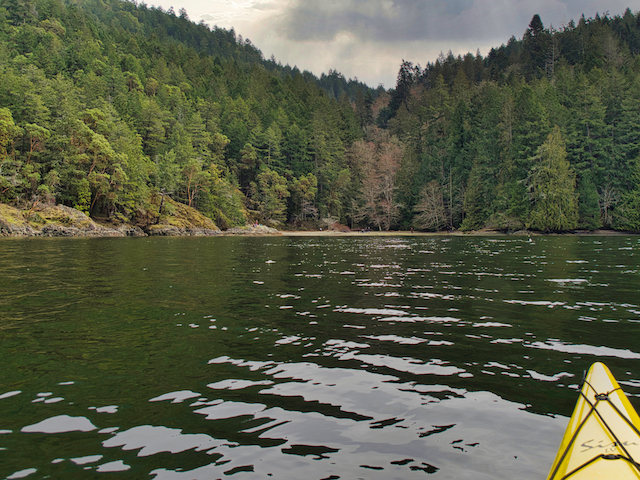
Approaching McKenzie Bight by kayak
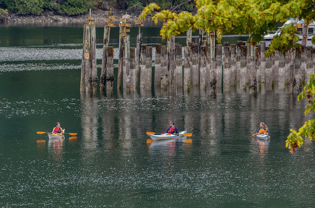
Kayaks in Tod Inlet
Mountain Biking
Bicycles are permitted on designated, multi-use trails accessed via all three trailheads. Consult park maps at each location for more information. Cyclists must stay on designated trails and must yield to hikers and horseback riders.
Horseback Riding
Pets on Leash
Swimming
Wildlife Viewing
Maps
These are links to maps of Gowlland Tod Provincial Park:
Click HERE for Map #1 – South Section
Click HERE for Map #2 – Middle Section
Click HERE for Map #3 – North Section
Click HERE for Map #4 – Entire Park
Photos
If you would like to see more photos of Gowlland Tod Provincial Park or purchase photos, check out our sister website: Brakelightfoto – Gowlland Tod


[…] Gowlland Tod Provincial Park is located on the east side of Saanich Inlet encompassing a significant portion of the Gowlland Range near Victoria on Southern Vancouver Island, BC. It also includes a significant portion along Tod Inlet, running from Wallace Dr down to the location of the old cement plant on the north side and the entire southern and western shore. The Tod Inlet section connects with the Gowlland Range section on the ridge above Tod Inlet, up above Durrance Lake Regional Park. […]