
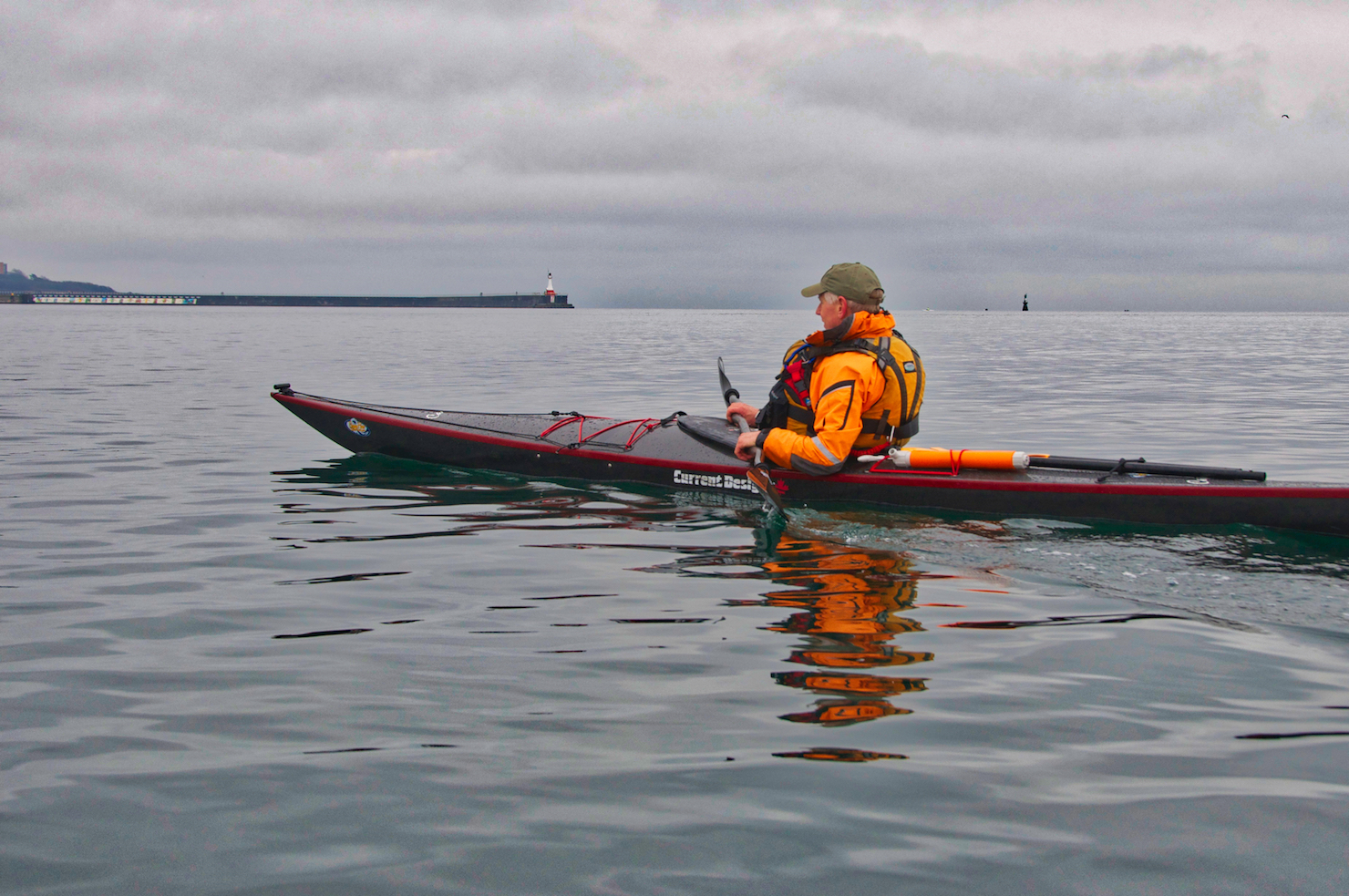
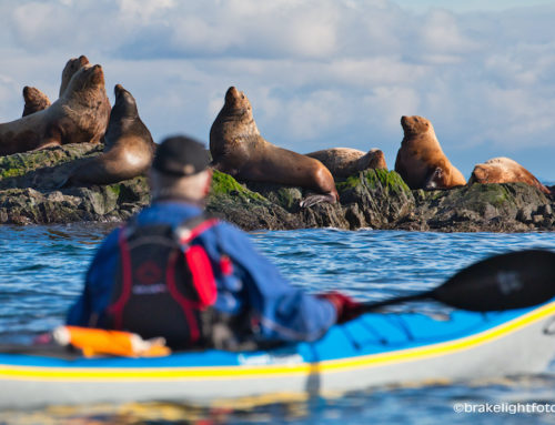
Kayak in Victoria Harbour
There are some wonderful paddling opportunities right in Victoria Harbour. Whether you kayak, canoe or stand up paddle board (SUP), whether you’re a beginner or an expert, you can tailor a paddling trip anywhere from an hour to a few hours that will be sure to please. Victoria is a working harbour with lots of pleasure boats, water taxis, large car and passenger ferries, tugboats with barges, cruise ships and lots of seaplanes! You will pass many historic buildings and structures, see lots of wildlife including harbour seals, bald eagles, great blue herons, the occasional sea lion, and even Orca’s! Victoria Harbour and it’s surrounding waterways are also a migratory bird sanctuary, so depending on the time of year there are lots of migratory birds in and around the harbour. There are few small beaches around the harbour making for easy pullouts if you would like to stop for a break or grab some lunch. If you would rather eat out, there are pubs, like Canoe Brewpub, right on the water with dock access for paddlers. There are also floating restaurants and coffee shops at Fisherman’s Wharf which also cater to the paddling crowd. Without a doubt Victoria’s harbour is a fun and exciting place to paddle!
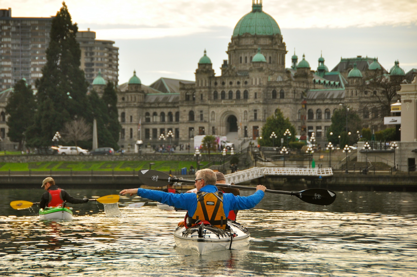
The Inner Harbour and the BC Legislature Buildings
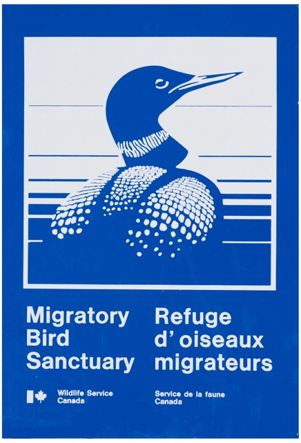
A sign you may see around the harbour as Victoria Harbour is a Migratory Bird Sanctuary

Where To Start
If you need to rent equipment, there are a few places that rent kayaks and standup paddle boards from docks right on the harbour, the largest being Ocean River Sports at the bottom of Swift St. with docks in front of the Canoe Brew Pub. For a complete list of other rental location see out post: Kayak, Canoe, SUP Rentals in Victoria. Visitors with their own equipment are also welcome to launch from the Ocean River docks.
Safety Considerations
Before you decide to paddle in Victoria Harbour, it is imperative that you familiarize yourself with the regulations and guidelines. As the busiest harbour in Canada and an official water airport, there are specific places you can paddle and where you cannot. To see a complete list of the regulations for boating in the harbour, including a map of the Port of Victoria Traffic Scheme, click this link: Port of Victoria Traffic Scheme. For a comprehensive list of safety guidelines for paddling in the harbour and around southern Vancouver Island, check out our post: Safety Guidelines for Paddling Around Victoria.
Where to Launch
Ocean River Sports Docks
Ocean River Sports has docks located at the bottom of Swift St. in front of the Canoe Brewpub. Visitors are welcome to launch their kayaks from the Ocean River docks for easy access to the Upper & Inner Harbour and the Selkirk and Gorge Waterways. For more information: Ocean River Adventures
Songhees Point
There is a gravel beach in front of the Delta Hotel. Street parking is available but with a 2-3 hour limit. It is a short walk from the street to the waters edge. Quick and easy access to the Inner & Middle Harbour.
Banfield Park
There is a parking area located at the end of Styles St (off Craigflower Rd). Follow the path down to water. There is a public dock here making for easy access to the Selkirk Waterway, the Gorge Waterway and the Upper Harbour. The parking lot at the park entrance will only handle 4 vehicles plus there are 2 more on the street nearby that aren’t restricted to residential parking. There is more street parking further up Styles St closer to Craigflower.
Fleming Beach
Located at Macaulay Point Park at 1101 Munro St in Esquimalt. There is good parking and a boat ramp and docks belonging to the Esquimalt Anglers. If you want to use the ramp and docks there is a launch fee of $10.00 per boat, or you can use the beach to the right of the ramp for free. Warning: If you are using this launch to access Victoria Harbour, make sure to check the weather as the waters off Macaulay Point are very exposed and conditions can change quickly.
James Bay Anglers Boat Ramp
Located in James Bay at 75 Dallas Rd. There is a $5.00 fee for launching boats here. Quick access to the Outer Harbour.
Selkirk Beach
Located just off Waterfront Crescent (off of Jutland) there is a small beach located at the head of the bay between the Galloping Goose Trail and the street. It is beach launch, but it can be a little mucky. Just follow the path down to the beach. Street parking is limited and make sure to check the signs for restrictions. There is a pay lot available just down by Gorge Rowing and Fitness Center. Access to the Selkirk and Gorge Waterways and Upper Harbour.
Paddling Routes
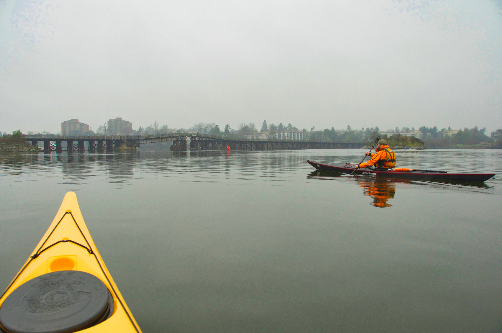
Depending on your time and your interests, there is a lot to explore in the harbour. The harbour can be broken up into sections; the Outer Harbour, running from the entrance at Ogden Pt Breakwater to Shoal Point. The Middle Harbour, running from Shoal Point to the narrows between Laurel and Songhees Points, the Inner Harbour which encompasses the waters between the narrows and the Johnson St bridge, and finally the Upper Harbour, which is north of Johnson St Bridge up to the Bay St Bridge. The waters between the Bay St Bridge and the Selkirk Trestle are known as the Selkirk Waterway and the waters past the trestle are the beginning of the Gorge Waterway, the subject of another post. You can choose to do just one of these sections, a couple of them or all of them depending on your time. A complete tour of the harbour can take 3 -4 hours, depending on how much time you take for sight seeing, pictures, socializing etc.
The Upper Harbour
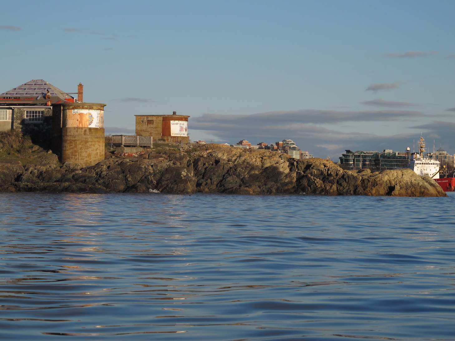
To access the upper harbour you will head north under the Johnson St Bridge. Be cognizant of boat traffic coming under the bridge and stay to one side or the other. This is the industrial section of the harbour. You will see Point Hope Shipyards on the left and on your right you will pass the docks in front of the Canoe Brewpub, an excellent spot to stop for a meal after your paddle. You will also find the Ocean River Sports docks here and, when they are in port, the SALT (Sail & Life Training Society) tall ships, the Pacific Grace and the Pacific Swift. As you head north you will pass by Capital Iron, a truly unique and local general store, which began as a scrap business in 1934. It is housed in an historic building that was built in 1863, originally a flour mill. The building beside Capital Iron was also part of the mill.
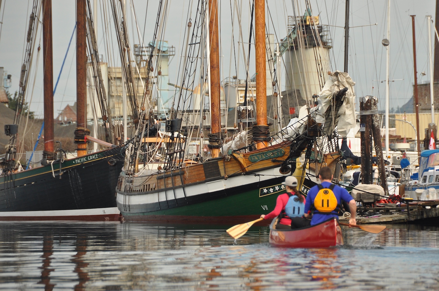
Sailor & Life Training Society (SALTS) Tall Ships, the Pacific Swift & Pacific Grace
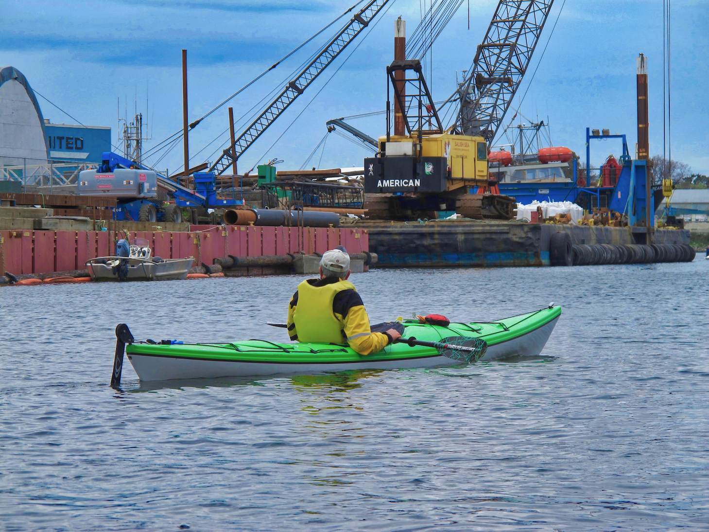
There is lots of industrial activity in the Upper Harbour
The Selkirk Waterway
As you continue to paddle north you will pass under the Bay St Bridge and enter the Selkirk Waterway. The earliest bridge here was known as the Point Ellice Bridge, and was originally a wood structure. On May 26, 1896, a streetcar crowded with 143 revelers, on their way to attend Queen Victoria’s Birthday celebrations, crashed through the bridge and into the water. 55 men, women, and children were killed in the accident, making it one of the worst transit disasters in BC.
Once you are under the bridge, to your right you will see a dock with a pathway leading up to Point Ellice House. Point Ellice House was built in 1867 and was originally owned by the O’Reilly family. This house and property remained in the family’s possession for 108 years. The house and all of its contents were sold to the Province of British Columbia in 1975. The O’Reilly family left behind everything, including their furniture, kitchen utensils and dishes, board games, window coverings and wallpaper to clothing and more, making Point Ellice house a truly unique National Heritage Site. Stop in for lunch or a Victorian-Style afternoon Tea and take a tour of the home. There is a beach in the cove behind the dock where you can land and there is a staircase leading up to the property. For more information click this link: Point Ellice House.
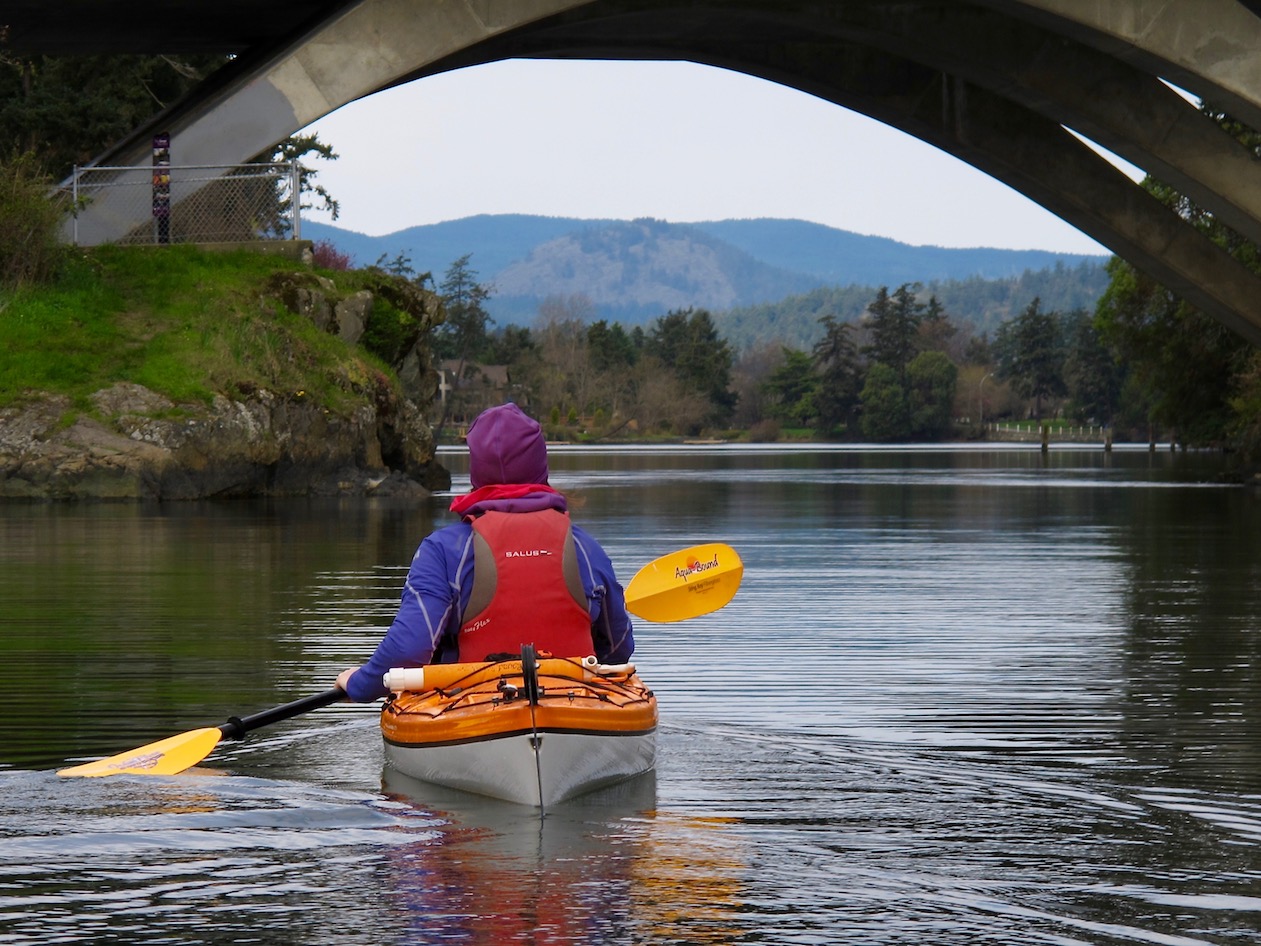
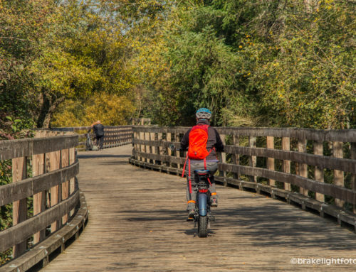
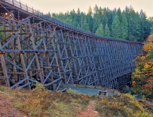
Once past Point Ellice, you will see the Selkirk Trestle ahead of you. This 91 meter (300’) long wood structure was built by the Canadian National Railway in 1916. It is now a walking and bike path, part of the Galloping Goose Trail, which starts from downtown Victoria near the Johnson St Bridge and runs 60 kms (37 miles) to Leechtown, the site of a gold-rush town out past Sooke. The trail was named after a gas-powered passenger rail car that ran on the line from 1922 to 1931.
The Selkirk Trestle in the Selkirk Waterway
Just before the trestle and off to your right is Halkett Island also known as Deadman’s Island as it was a burial site for the the Songhees and Esquimalt First Nations people. Sometime in 1867, a few school boys, who were swimming here, lit a fire to warm themselves. Unfortunately, there were piles of old coffins and trunks on the island, which caught fire. The subsequent inferno burnt everything on the island to the ground, including the trees and scrub.
On the north shore of the waterway and to the right of the trestle you will see the docks and facilities of the Fairway Gorge Paddling Club Society, which is a organization that is involved in dragon boat and outrigger canoe training as well as organizing races and events on the waterways around Victoria. This is also the location of the beach access off Waterfront Crescent.
The Gorge Waterway
As you pass under the trestle you will see the waterway begin to change with forested shores lined with homes and apartment blocks. On the hillside to your left is a Banfield Park, which offers great views, a playground, tennis court, basketball court, and washroom facilities and also has a dock to launch paddle craft from. Parking is at the end of Styles St. This dock is also the sight of the annual Gorge Swim Fest. In spite of the fact that the ocean waters around Victoria are very cold year round, the Gorge Waterway becomes quite warm in the summer. The Swim Feast happens in August and is a revival of the swim fest that occurred here over 100 years ago. Today the festival promotes & enables swimming in the Gorge Waterway by supporting initiatives that sustain the health, awareness & vitality of the Gorge Waterway.
The final destination of this route is the Gorge Tillicum Bridge. WARNING: Under the bridge is Tillicum Narrows and because of rising and falling tides, it is a reversing falls. This natural wonder has currents that can run as fast as 22 kph (12 mph) on the outflow. Be extremely cautious even when approaching this area as the eddylines, (the transition between the main current and the slower waters moving in the opposite direction near shore), can easily capsize unwary and/or inexperienced paddlers. There is a public dock on the right (north side) where you can get out and take a break. The docks on the left (south side) are privately owned and marked as such, so do not land there. If you plan to paddle under the bridge you must take extreme care and check the tide and current tables in order to plan your trip when the tide is slack or at least slow enough to allow you safe passage both ways.
Approaching Tillicum Narrows at Slack Tide

Rapids under the Tillicum Bridge during an ebb tide
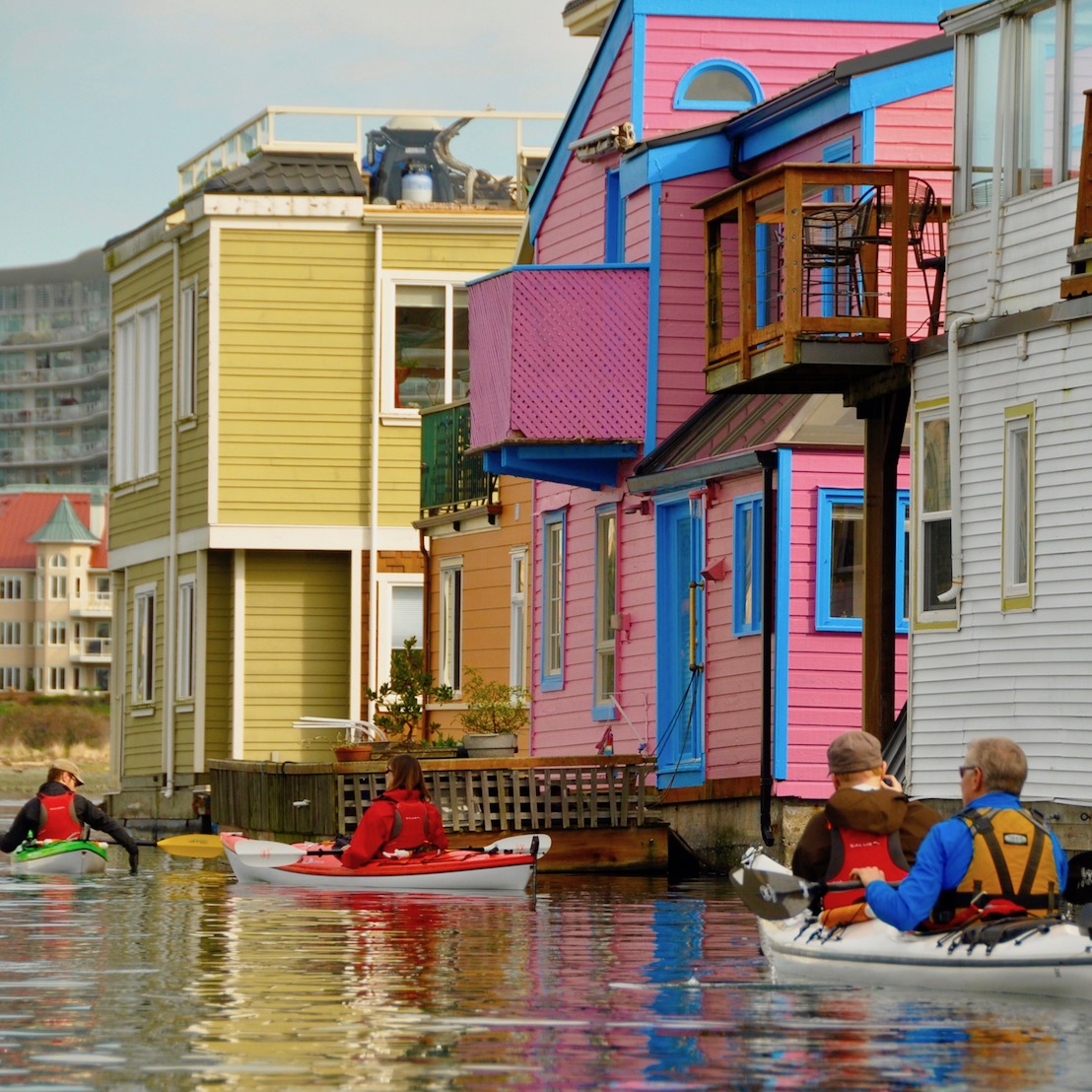
The Inner Harbour
If you are transiting the inner harbour from the upper harbour, stay along the north shore in front of the Delta Hotel as you approach the Narrows. If you are continuing to the middle and outer harbour you can stay along the north shore or cross at the Narrows when it is safe to do so and follow the shore along to Fisherman’s Wharf and beyond. If you want to paddle around the Inner Harbour, extreme caution must be taken. It is very busy with Harbour Ferries, seaplanes, pleasure boats and large ferries. Never assume you have the right of way. In restricted waters such as this, large vessels have the right of way and in fact may not even see you, and seaplanes are not very maneuverable. Be patient and let larger vessels and seaplanes get out of the way. If you decide to pass the Harbour Air seaplane docks, stay 50m’s away from the aircraft and do not paddle under the wings!
Passing the Harbour Air seaplane docks requires caution. Stay well clear and do not paddle under the wings.
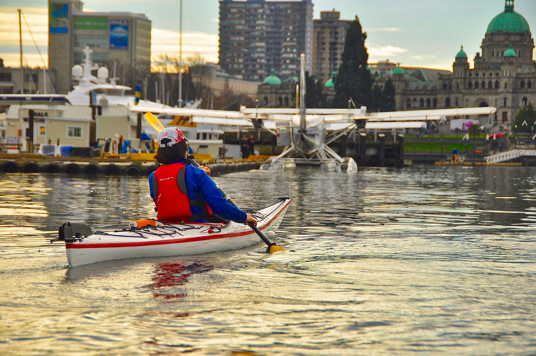
With warnings out of the way, the Inner Harbour is a very compelling place to paddle. The busy water traffic just mentioned is very interesting, but there are also many interesting and historic structures along the Inner Harbour. On the east side of the harbour all along Wharf St there are rows of historic buildings many of which were warehouses dating back to the late 1800’s. Just before reaching the seaplane docks look up to your left, you will see a beautiful pink building on the upper slope. This is the Old Victoria Customs House or the ‘Malahat Building’ built in 1875. The point of land just to the south of the Customs House and behind the seaplane docks is known as Ship Point, site of many festivals and music events held here in the summer time. For a listing of what’s happening in Victoria, check our post: Festivals & Events

Historic buildings, and lots of boat activity make the harbour an interesting place to paddle
As you look into the inner harbour Past Ship Point, you will see a large granite wall lining the harbour. Known as the ‘Causeway’, this wall was built in 1903 and allowed for the subsequent filling in of the James Bay mud flats where the Fairmont Empress Hotel now stands. The lower walkway was not part of the original wall and was added in 1974. The Empress Hotel was built by the Canadian Pacific Railway in 1908 as a terminus for Canadian Pacific’s steamship line. The Empress was key to establishing Victoria as a primary tourist destination on the west coast of Canada.
To the south and across the street from the Empress, is the Royal British Columbia Museum founded in 1886, and cross the street from the museum and dominating your view to the south is the highlight of the inner harbour, the British Columbia Parliament Buildings. First opened in 1898 they were designed by the famed architect Francis Rattenbury who subsequently designed the Empress Hotel and the CPR Steamship building as well as many homes around Victoria.
The Steamship Terminal was built in 1924 and now houses The Steamship Grill & Bar and the Robert Bateman Centre (moving to a yet-to-be-determined location in Mid-March 2023), which displays the work of this famous wildlife artist. As you pass the Steamship Terminal, you will come upon the Blackball Ferries Terminal, where the MV Coho car and passenger ferry arrives twice a day from Port Angeles, WA. Just past here is the Clipper Catamaran Ferry terminal, which offers passenger service between Victoria and Seattle. Be cognizant of departing and arriving vessels. Tip: If the MV Coho sounds 3 blasts of its horn, it is preparing to depart.
The end of the Inner Harbour paddle is Laurel Point, at the narrows. If you are circumnavigating the Inner Harbour you can cross at the narrows back to the north side and head back towards the upper harbour, or continue along the south side into the Middle Harbour towards Fisherman’s Wharf. Optionally you can cross the narrows and explore the north shore of the harbour and Esquimalt’s Westbay.
The Middle Harbour
The Middle Harbour contains one of the landing and take off areas for seaplane traffic. There are yellow buoys marking this strip. All vessels under 20m (65’) must keep these buoys to their port (left) side and not enter this zone. Crossing this area is prohibited whether there are aircraft present or not. Paddle craft should stay closer to the north shore or the docks of Fisherman’s Wharf to avoid conflict with Victoria Harbour Ferries and powered pleasure craft. For more information on Victoria Harbour rules and regulations click this link: Victoria Harbour Traffic Scheme
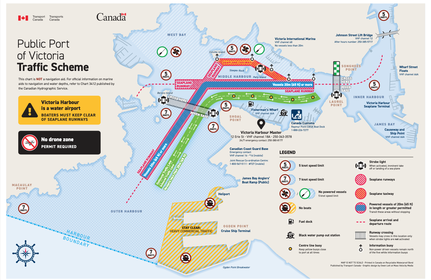
Port of Victoria Traffic Scheme – Click to Enlarge
As you approach Fishermans Wharf, you will see lots of float homes. If you would like to explore this neat little village and partake of some of the great things Fisherman’s Wharf has to offer including; Barb’s Fish & Chips, The Fish Store & More, Gilligans’s BBQ, Jason’s Ice Cream, Hi Gear Crab Sales, Moka House Coffee, Rockin’Rolls and Puerto Vallarta Amigos Mexican Food, paddle down between “D” & “E” docks. At the end of this passage you will find a low platform for getting in and out of your boat. If you do decide to land, move your boats clear of the platform so others can land. There are restrooms very close to the loading area. (Please note that while you can land at Fisherman’s Wharf to partake in some of the food offerings, you cannot launch your kayak from shore here).
Kayaking past float homes at Fisherman’s Wharf
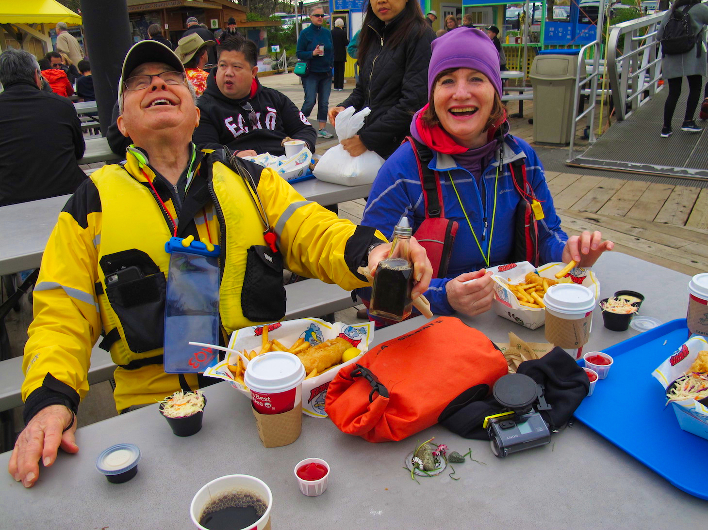
Kayakers enjoying lunch at Fisherman’s Wharf
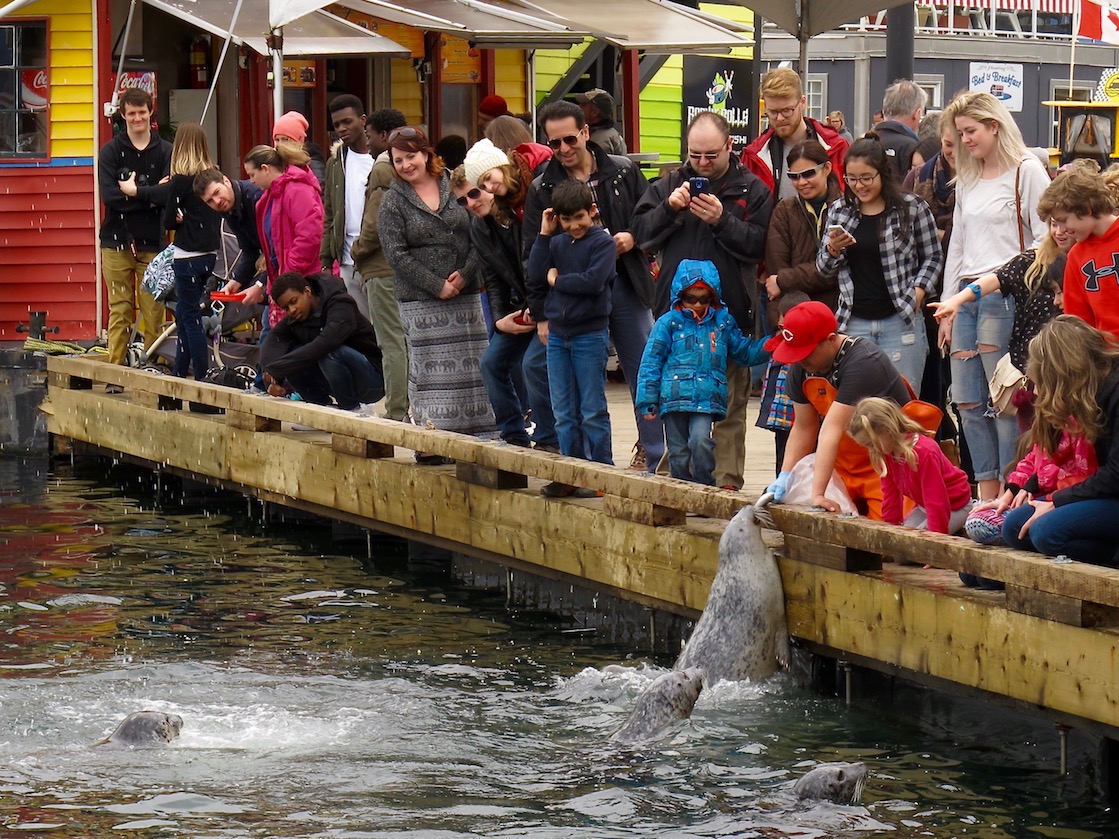
The Fisherman’s Wharf docks can be very busy. It is a popular place to watch the seals although it is no longer legal to feed the seals.
Once back in your boat, head back out the slip and turn left. Continue around the point of land (Shoal Point) with the Harbour Control Tower on it. As you round this point you will pass by the Canadian Coast Guard facility. Further along you will pass the James Bay Angler’s Boat ramp, and shortly thereafter, the heliport used by Helijet Airways. Stay well away from the shore as you pass the heliport. This area is restricted as there can be a serious downwash created by the helicopters taking off and landing. See the Traffic Scheme Chart.
Next you will pass by the Ogden Point Cruise Ship Terminal. Victoria is Canada’s busiest cruise ship port of call, so during the tourist season, from near the end of April to the end of September, there is almost always a cruise ship or two docked here, and sometimes more. Exercise extreme caution when passing these docks.
Once past the cruise ship docks, you will see the Ogden Point Breakwater. This imposing 800 meter (2,500 foot) granite and concrete breakwater was completed in 1916. It was built in anticipation of an increase in shipping expected from the Panama Canal, which was under construction during that time. Make sure you paddle in along the inside of breakwater and check out the beautiful ‘Land and Sea’ mural project, called the ‘Unity Wall’, which when completed, will cover the whole 800 meters of the breakwater. The mural was a project initiated by the Greater Victoria Harbour Authority in collaboration with the Songhees and Esquimalt First Nations and shares the legends of the Coast Salish people. To learn more about this project click this link: Land and Sea Mural
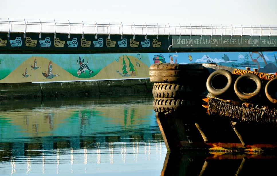
The ‘Unity Wall’ on the Ogden Point Breakwater
Warning: If you decide to venture out to the exposed side of breakwater, be very careful of the water conditions that can be experienced here. Currents off the point can run at 1 knot, which can create rips (standing waves). As well, if there is a swell, very confused sea conditions can occur as the waves rebound off the breakwater.
Ogden Point is the end of this route. You can turn around from here and follow the same route back, staying close to the shore to avoid incoming and outgoing boat traffic. Pass in front of Fisherman’s Wharf this time, back to the ‘Narrows’. Check carefully for traffic before crossing at the ‘Narrows’. Remember, if the white lights are flashing you are not permitted to cross. Follow the shore in front of the Delta Hotel back under the bridge, crossing back to the right side anytime it is safe to do so, and continue to the Ocean River Docks.
If you would like to paddle back along the Esquimalt shore and north side of the harbour you should paddle back to Shoal Point and cross to Berens Island and Work Point. Make sure to check for traffic and make sure the white light on the island is not flashing before you cross. Continue to follow the shoreline staying inside the white marker buoys. If you are up to it you can go left to McLoughlin Point before you head back, where you will see some range finding/spotlight emplacements from World War II.
WW II Era Searchlight Emplacements at McLoughlin Point
The Outer Harbour and Ogden Point Breakwater
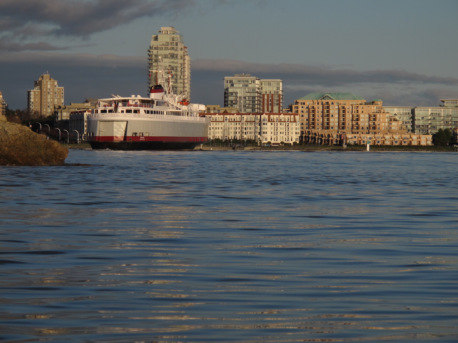
The Coho Ferry entering the Middle Harbour
On the return trip you will pass by Westbay Marina with its boat moorage and colourful float homes. As you continue towards the north shore of the harbour you will spot the West Song Walkway, a very popular walk, which runs all the way from Westbay in Esquimalt to the Johnston St Bridge. You will paddle past Colville Island, and then cross Lime Bay. Located at the head of Lime Bay you will see Spinnakers Brew Pub. Spinnaker’s was Victoria’s first brewpub, and it is still a great place to grab a pint of great local beer and a meal after your paddle. While you could land in Lime Bay, the shore is quite rocky and steep climb up the banks to the walkway. As you continue your paddle back to the inner harbour you will pass the new Victoria International Marina built for mega yachts. Be cautious of rebound waves off the docks here. Beyond this the West Song Walkway closely follows the shoreline with a backdrop of the condos of Shonghees.
Happy Paddling!!
Don’t want to go by yourself? Take a Tour!
Ocean River Sports has facilities right on the harbour and offer kayaking and SUP tours of the harbour. Use this coupon code for a 5% discount when you book a tour: VISITORVIC
Other Paddling Resource Articles
Safety Guidelines for Paddling Around Victoria
Paddle Sport Rentals in Victoria
Paddling Tours in Victoria
BC Marine Trails Network
Paddling Instruction in Victoria
Ocean River Sports Blog
Ourhomehas6wheels – BC Kayaking Trips
There is NO publicly accessible kayak launch place at Fisherman’s wharf. The only launch spot is privately owned and has signage.
Hi Marika,
Thanks so much for your comment and our apologies for not responding sooner. There was a time you could launch from Fisherman’s Wharf, but not any more as it has just gotten too busy, however, if you are paddling the harbour you can still land at their dock, they have a lowered platform for that purpose. I thank you for bringing this to our attention and we have edited the post to reflect that.
Cheers!
Bruce & Linda Holland
To exit at Fisherman’s Wharf, the kayak platform is located between docks D & E by the rest rooms (not C & D as stated on this page). At the end of C, there is a sign that says paddlers should enter between D&E. C&D is where the water taxi service is. C was well marked on the harbour side, but D & E letters may have been blocked by large boats mored at the ends (if they were labeled at all).