The Sooke Potholes
The Sooke Potholes are actually comprised of 2 different parks, Sooke Potholes Provincial Park and Sooke Potholes Regional Park. As you drive along Sooke River Rd, it is he provincial park the you first enter. This park is comprised of 7.28 acres along both sides of the Sooke River and extends north a short ways past Tod Creek. The river here is more serene dropping across some shallow rocky ledges and gravel beds. Beyond this point you enter Sooke Potholes Regional Park which covers an additional 63.5 hectares along the Sooke River.
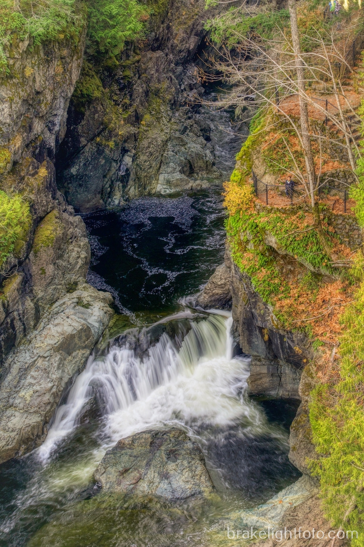
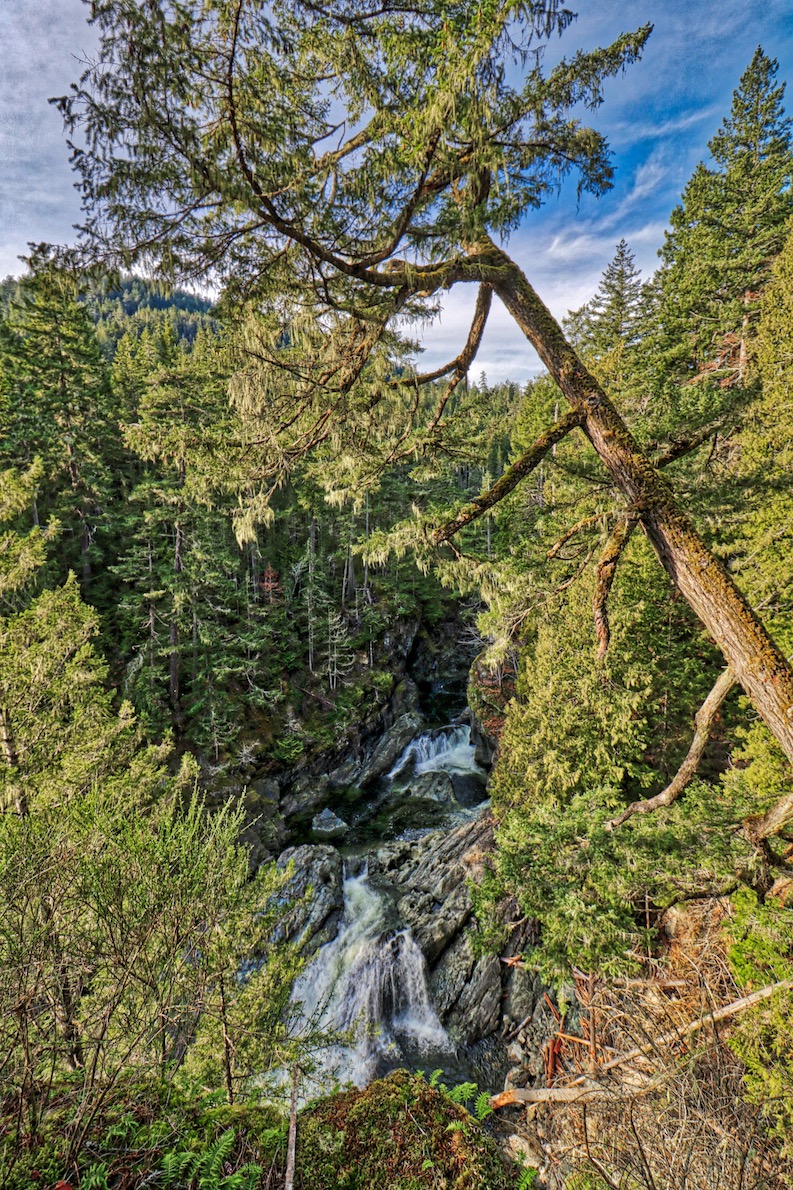
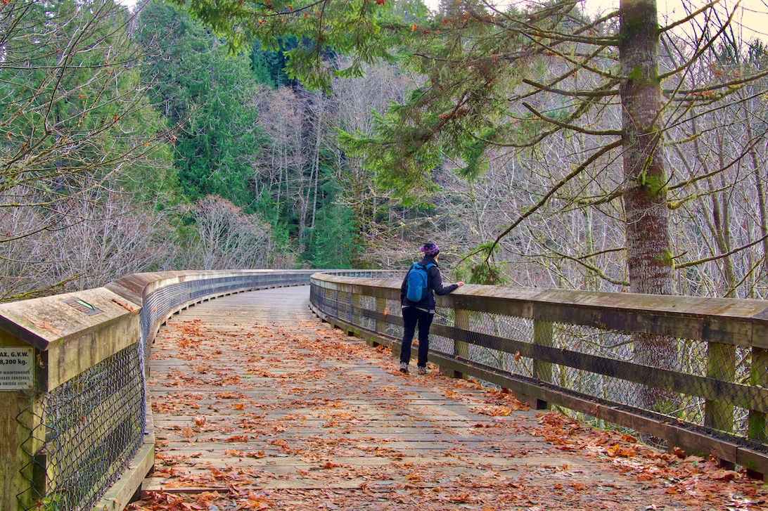
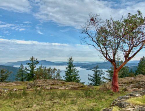
View area above the waterfall
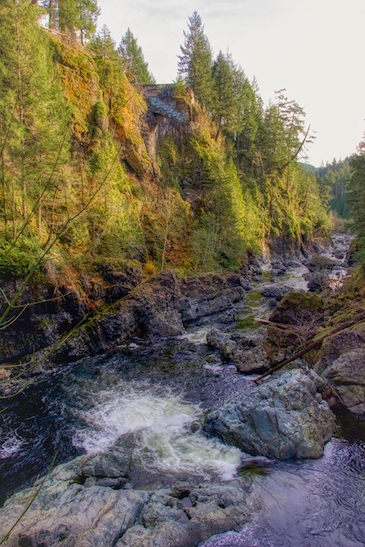
Up within the Regional Park, the Sooke River plunges through a narrow rock canyon and over a series of waterfalls before flattening out in the Provincial Park section. The “potholes” found in this part of the river are unique geological formations which are actually deep, polished rock pools carved into the bedrock of the river by the swirling waters, gravel and stones.
The waters of the Sooke River are beautifully clean and clear, providing a wonderful swimming and picnicking destination in the summer, however its spectacular natural beauty provides great exploring at anytime of the year.
The Sooke River is also an important Coho and Chinook salmon spawning river and the Sooke Potholes Provincial Park provides an excellent location for viewing the annual salmon spawning run.
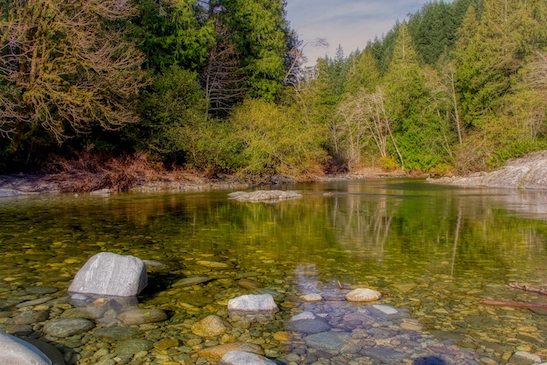
Pool of the Sooke River near the parking area of the Provincial Park, a great spot to watch spawning salmon.
Things to do
Nature and Culture
These parks provides wildlife viewing opportunities along an important coho and Chinook salmon spawning river. Both parks protects remnant old-growth Douglas fir and associated sensitive plant communities that line the Sooke River. The river itself is also an important wildlife corridor for all species, including black bear and Roosevelt elk, as it connects the Sooke Hills and Capital Region greenbelt. You may also see black-tailed deer, red squirrels or bald eagles sitting in the trees along the river banks or riding the thermals overhead.
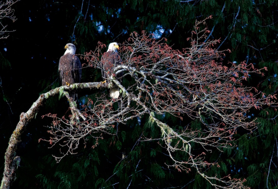
Bald Eagles in the Provincial Park
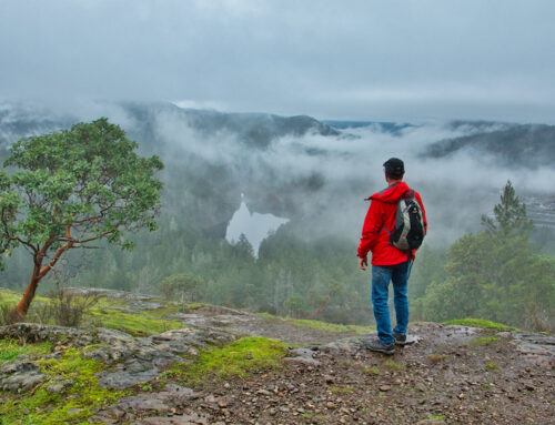
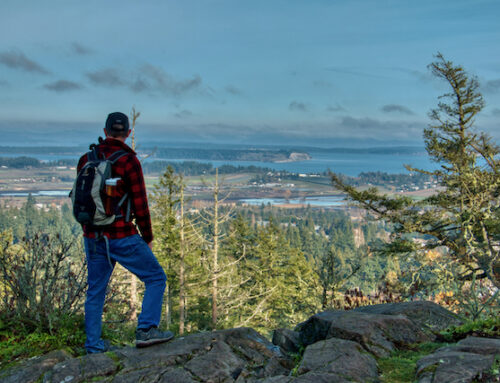
Hiking
There are several short trails along the river that lead to some spectacular viewing spots. You can also hike along portions of the Galloping Goose Trail which runs all the way from downtown Victoria, past the Sooke Potholes Parks and on to the site of a former gold mining town (see Biking for more on Leechtown).
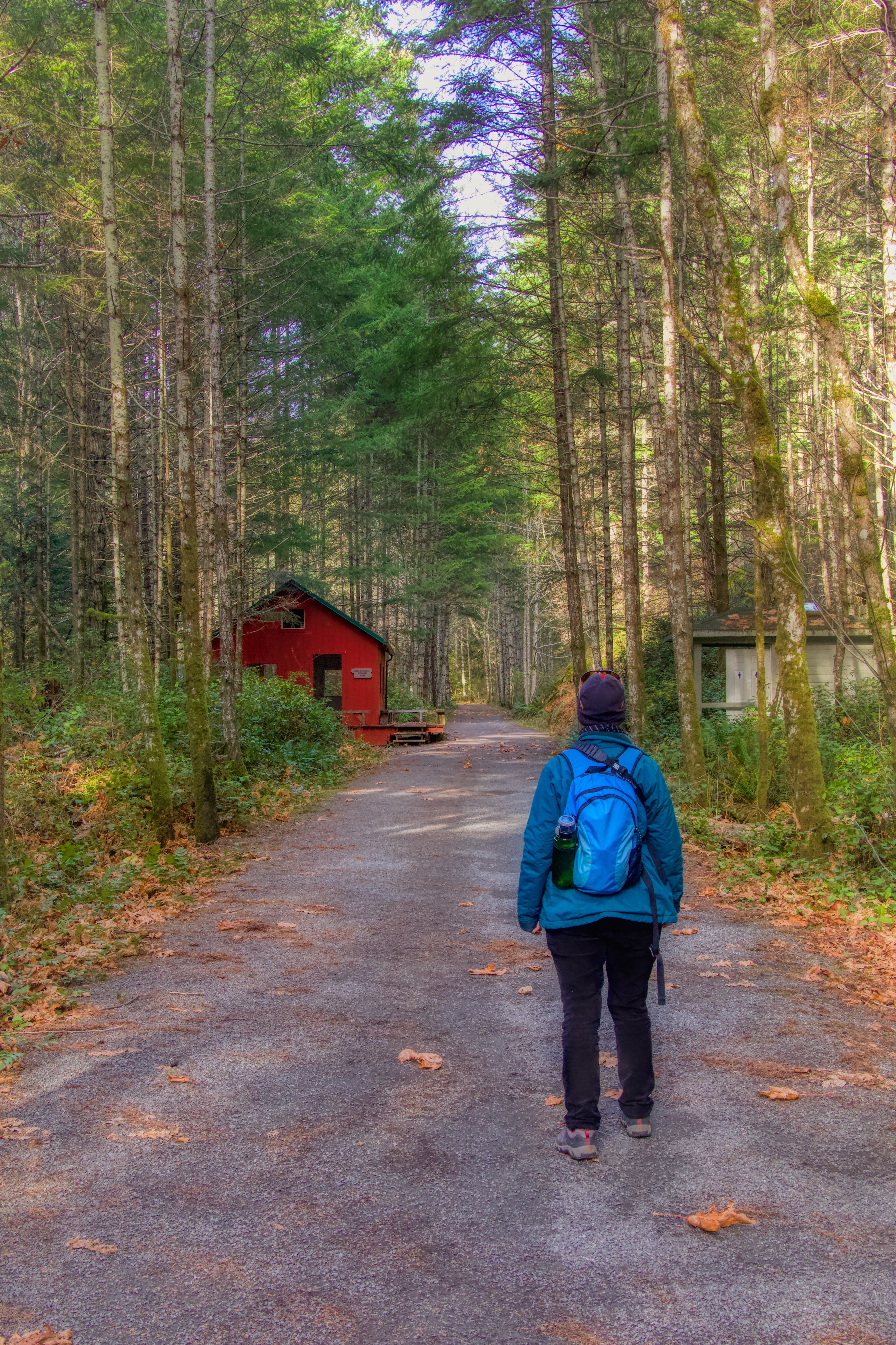
Hiking the Galloping Goose Trail at Sooke Potholes Regional Park
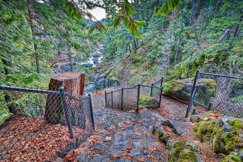
Hiking trail to one of the viewing areas in the canyon
The Deertrail Resort Ruins
While you’re wondering around the trails at the Sooke Potholes you will notice a large ruin on top of the cliffs looking out over one of the most stunning river views on the island. This ruin was once a dream of Victoria resident Albert Yuen who had purchased this 160 acre parcel along the Sooke River and it was destined to be come a spectacular luxury resort. The resort was started in the early 1980’s and was known as the Deertrail development and was to become a 2,800 square meter stone and timber lodge with hand-cut sandstone arches, natural stone stairs and a magnificent, 4 sided fire place with 250 guest rooms. Sadly over the next 2 decades the project only moved forward sporadically and eventually stopped and fell into disrepair.
Biking
Sooke Potholes Regional Park is a great starting point for a trip by bicycle or on foot on the Galloping Goose Regional Trail. If you travel south towards Sooke Rd and Roche Cove Regional Park, you will cross two spectacular railway trestles, both just a short distance down the trail from the parks, one at Tod Creek and the other at Charter’s Creek. If you travel north you will pass through some spectacular wilderness scenery as you follow the Sooke River all the way to the end of the trail at Leechtown, the site of a former gold mining town.
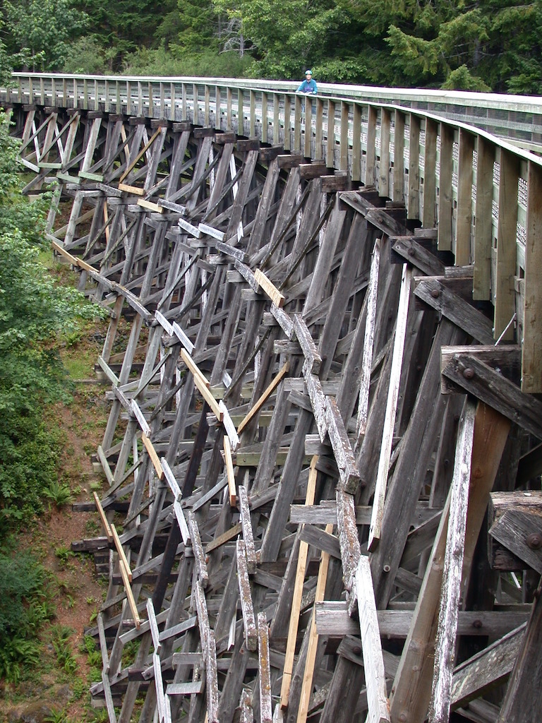
The Tod Creek Trestle
The Charter’s Creek Trestle
Gold was discovered in 1864 on the Leech River which led to the rapid establishment of Leechtown. In fact, within weeks after the discovery hundreds of miners traveled here to try and claim their fortunes. In fact, within four months after the discovery of gold, there were (an estimated) 6 general stores, 3 hotels and over 1,200 miners at work in the area! The gold rush was pretty much over in 1865 but the town survived on small mining and logging into the late 1950’s. Today nothing remains except a clearing in the forest.
You will know you are at the Leechtown site by the kiosk and rest area for Kapoor Regional Park. The park is adjacent to the historic site of Leechtown, and is the site of former railway logging operations. Kapoor is dedicated by the Kapoor family in memory of “pioneer lumberman and visionary” Kapoor Singh Siddoo (1885-1964). The park offers a bike rack, information kiosk and toilets at the rest area.
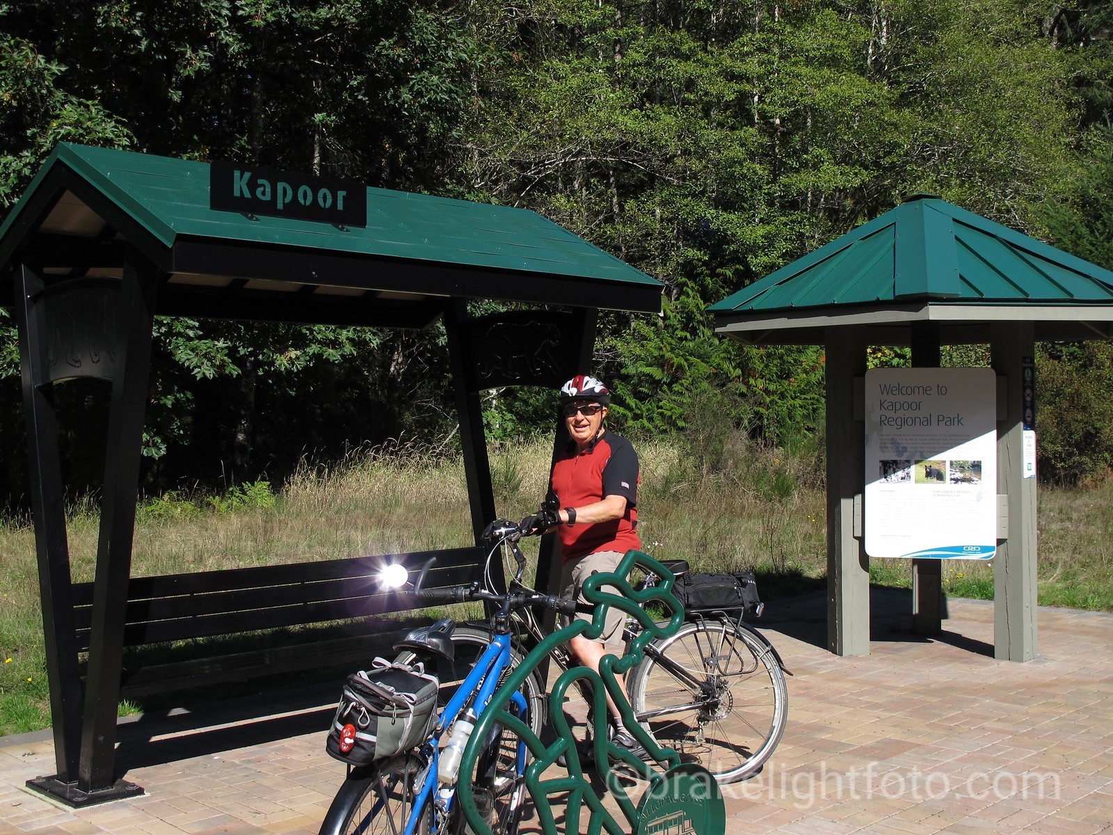
The Kapoor Kiosk at Leechtown, the terminus of the Galloping Goose Trail
Fishing
Opportunities for catch-and-release fishing exist in this parks, but restrictions apply. All anglers should check the current fresh water regulations issued by BC Fish & Wildlife Branch. Anyone fishing or angling in British Columbia must have an appropriate license.
Pets
Swimming
Canoeing
There are limited opportunities for canoeing or kayaking in this park. Some paddlers will put in at the parking lot in the provincial park and paddle the Sooke River down to the bridge on Sooke Road or continue down into the Sooke Basin.
For more images of the Sooke Potholes area, see our sister website: BRAKELIGHTFOTO.COM
Facilities Available at the Sooke Potholes
Picnic Areas
Pit or Flush Toilets
The provincial park has 2 pit toilets, located at the paved parking lot. Their are also pit toilets in the regional park near the parking areas.
Campground
The Spring Salmon Place (KWL-UCHUN) Campground is located in the regional park and operates seasonally each summer on a first-come, first-served basis. No online or phone reservations. The campground is open roughly mid-May to mid-Oct.
The 67-site RV and tent campground is located at the north end of Sooke Potholes Regional Park and adjacent to the Galloping Goose Regional Trail. The campground is a local favorite on Vancouver Island and offers a high quality, self-contained wilderness camping experience.
Services provided:
- Some riverfront views
- Public garbage bins, food scraps bins and recycle bins
- Toilets
- Drinking water station
- Picnic areas
- Individual fire rings, firewood for sale (except in case of fire ban)
- Caretaker on site
The campground does not provide hydro, dumping station or showers.
Cellular phone service is limited.
Campground Operation
The Spring Salmon Place (KWL-UCHUN) Campground is managed by the CRD and operated by T’Sou-ke Nation.
Questions? Call T’Sou-ke Nation at 250.642.3957 or CRD Regional Parks 250.478.3344 CRD Sooke Potholes Regional Park

How to Get There
Follow the Trans-Canada Highway from Victoria, and take the Millstream Road exit (Exit 14) to Sooke. Follow Veterans Memorial Parkway, then turn right on Sooke Road. Turn right on Sooke River Road and follow the signs. Allow approximately 45 minutes driving time from Victoria.
Public Transportation
Take BC Transit #61 from Victoria to Sooke River Road (ask the driver to let you off as close as possible), then a several kilometre hike along Sooke River Road. Contact BC Transit for schedule information.
[…] is exactly what happened when I headed to Sooke Potholes Provincial Park with my family for a hike. I had gone in search of pictures of the Potholes, and what I discovered […]
[…] across the Sooke River Bridge on your left is the Sooke River Road which leads to Sooke Potholes Provincial Park. Here you will find access to the series of deep, polished rock pools and potholes carved naturally […]
This is an excellent guide for first-time visitors. Thank you Linda!
Does anyone know if one can legally pan for gold in the potholes parks or in the area? Thanks for any info.
Hi Greg, I don’t know for a fact but I would guess you cannot. The potholes and surrounding streams are part of the provincial park and also there are sensitive areas where salmon spawn and cannot be disturbed. For first hand information I suggest you contact the parks department and ask them directly. https://bcparks.ca/info/feedback/
Cheers!
linda
[…] we were out at this place out in Sooke on Vancouver Island, and we had a beautiful day down at the Sooke potholes, and had a great meal.Like most vacations I bring my guitar because a) it’s soothing, and b) […]