The Pacific Marine Circle Route or South Island Spirit Loop
The Pacific Marine Circle Route, also now known as the South Island Spirit Loop, follows the coastline from Victoria through Sooke and out to Port Renfrew. Crossing the the end of San Juan Bay, it turns east and winds its way over the mountains along former forestry roads to Lake Cowichan and into the Cowichan Valley and down into Duncan. From here it follows Highway 1 through Cobble Hill, Mill Bay over the Malahat Drive and back into Victoria. Alternatively you can take a scenic short cut across the Saanich Inlet on the Mill Bay Ferry.
If you have a least a day to spend in Victoria and want to experience a good chunk of Vancouver Island, the Pacific Marine Circle Route is an excellent option. This 280 km driving loop takes you across coastal mountains, along inside coastal shorelines, up beautiful coastal valleys, and down rugged west coast shorelines. You can stop at pulls outs with broad ocean views of the Juan de Fuca, Haro and Georgia Straits. You will pass gorgeous beaches, tranquil lakes, rolling farmlands and vineyards and pass through many small west coast communities. You can walk beaches, hike, swim, kayak, canoe, SUP, surf and swim. You can visit provincial parks and you can even explore some of the most majestic old-growth forest on Vancouver Island. You can stop at coffee shops and restaurants, shop at little stores and galleries and even find delightful places to stay overnight if you have more time.
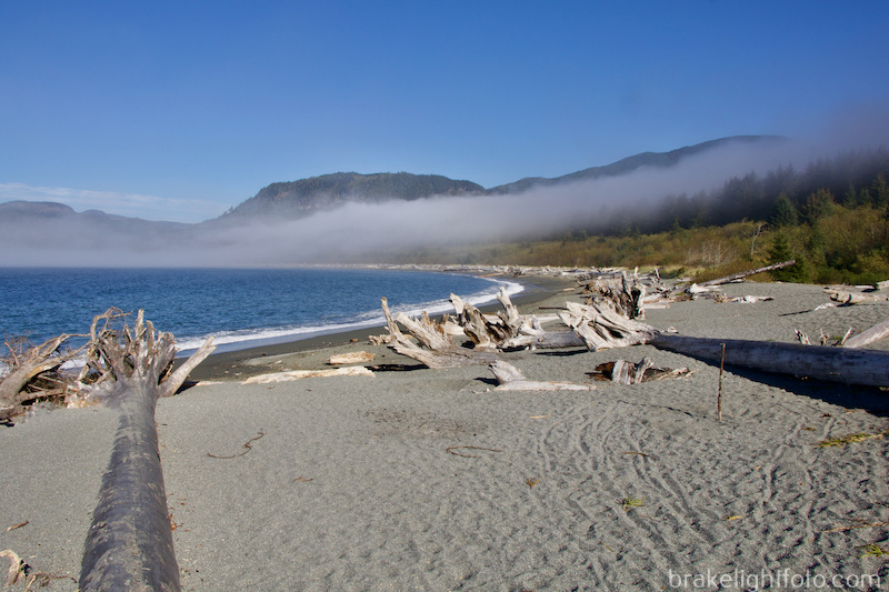
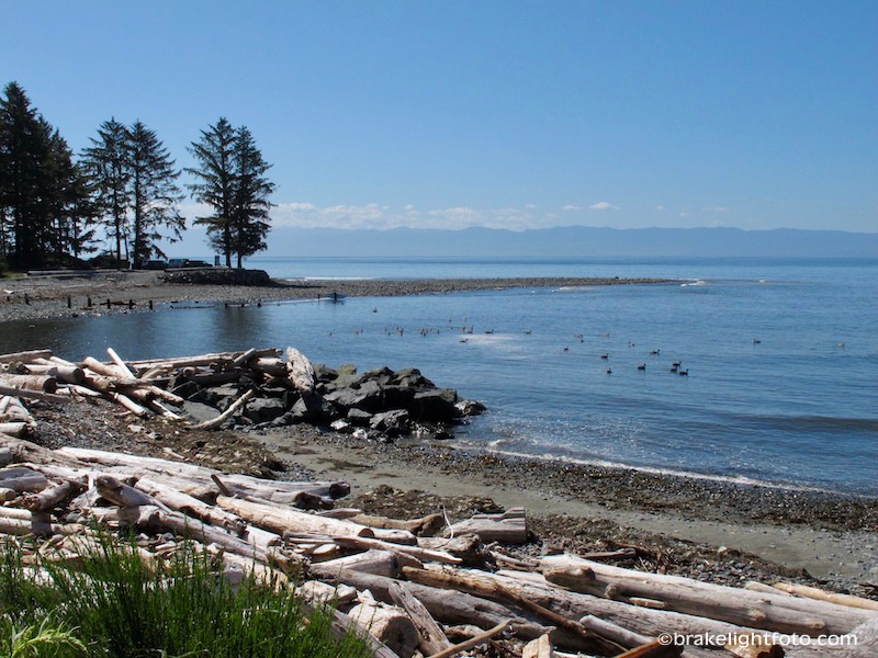
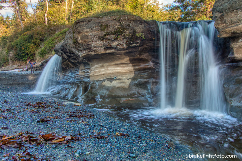
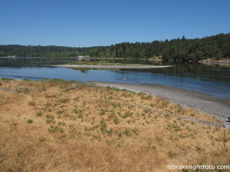
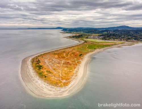
The San Juan River Estuary near Port Renfrew
The entire circle route is now paved, it wasn’t always. You should also be aware that along the western portions of the route you will be driving for long distances through wilderness and gas is only available in Sooke, Port Renfrew and Lake Cowichan, so make sure you check your fuel when leaving any of these places.
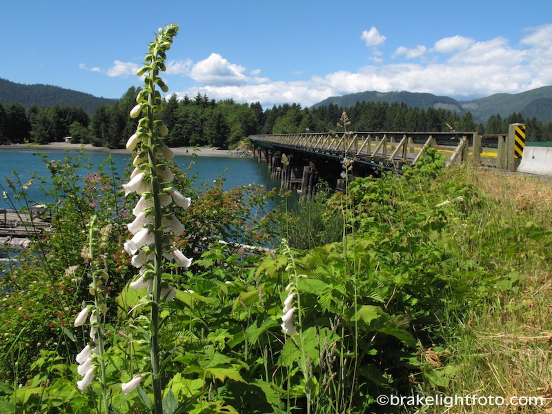
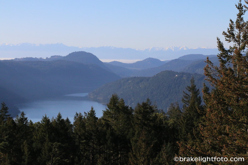
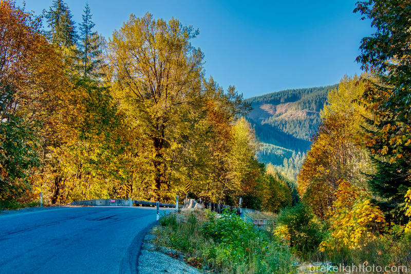
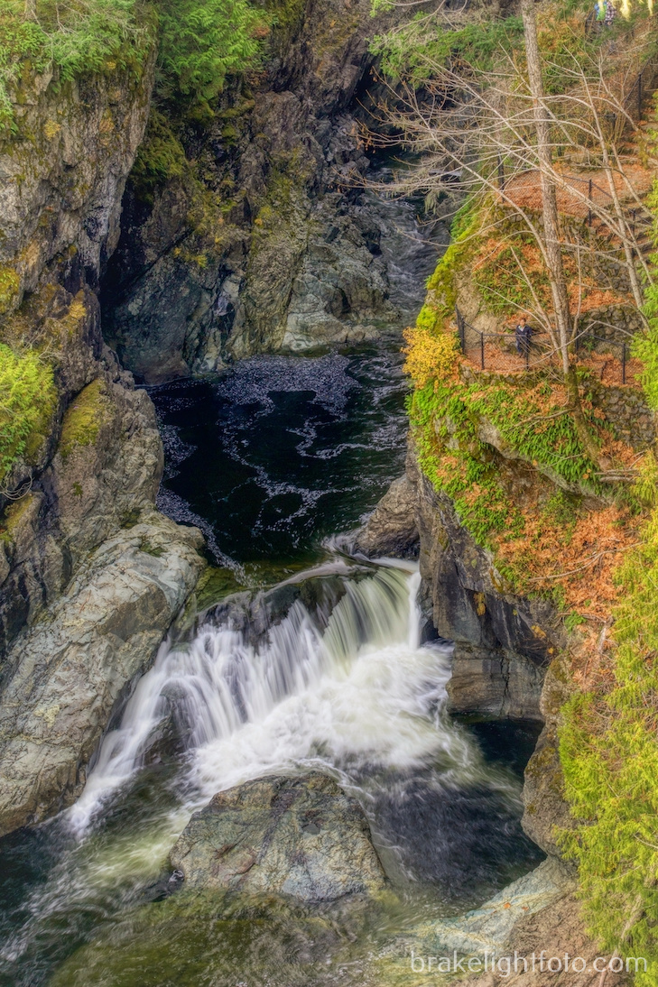
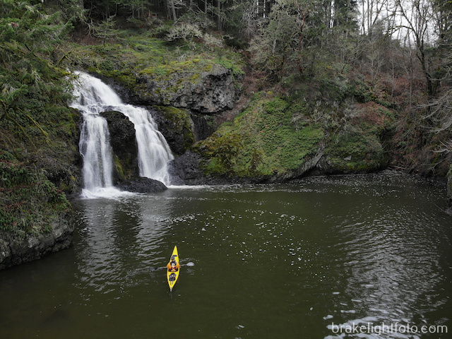
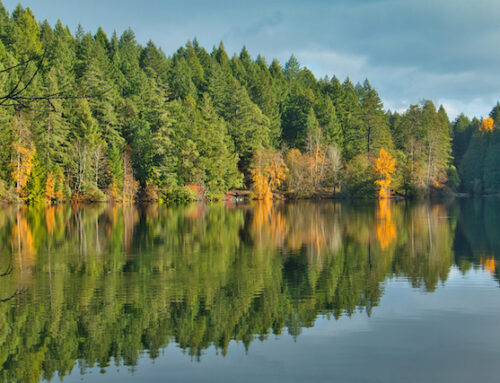
The Pacific Marine Circle Route near Port Renfrew
Forest fires pose a very real risk in the region during the summer months. At various points along the route there are signs indicating the level of fire danger and whether or not a campfire ban is in effect. Be aware of these and be appropriately cautious with smoking materials and any other source of open flame. Should you notice any indications of a fire, call 911 or alert residents who can do so.
Approximate Distances and Driving Times
Victoria harbour to Port Renfrew – 112 km (67 miles) approx 2 hours without stops
Port Renfrew to Victoria 155 km (93 miles) approx 2 hours 40 minutes without stops. If you take the Mill Bay Ferry instead of Driving the Malahat 144 km (86 miles) 3 hours 15 minutes depending on the ferry schedule.
Driving the Pacific Marine Circle Route – What to see and do
Mill Bay Ferry
We decided to start our trip from our home base in Saanichton by taking the Brentwood Bay to Mill Bay Ferry. By the time you line up early and sail the 25 minutes across, you really don’t save any time, but for us locals, it provides a little change from driving over the Malahat. The ferry offers great views of the Brentwood Bay area and Saanich inlet. If decide on this option, you should plan to get there early as this is a very small boat only holding about 16 cars.
The BC Ferries Mill Bay Ferry Schedule can be seen here by clicking this link: Mill Bay Ferry Schedule
Hot Tip:
Prepaid fares can be purchased at the following locations and will save you about 40% off the regular fare purchased at the ferry:
Thrifty Foods:
Broadmead: 100-777 Royal Oak Drive
Sidney: 9810 7th Street
Central Saanich: 7860 Wallace Drive
Mill Bay: 50-2720 Mill Bay RoadMill Bay Shell Service Station : 828 Deloume Road
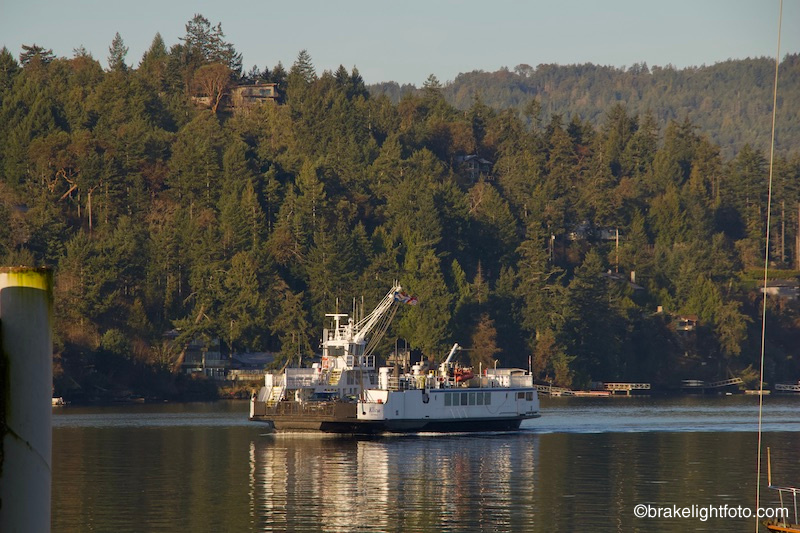
The BC Ferries, MV Klitsa, approaching the Brentwood Bay dock
The Malahat Drive
If this is your first time on the island you may not want to miss the Malahat drive and the amazing views it offers from the two pullouts at the summit. The Malahat Drive is part of the Island Highway (#1) and begins at Goldstream Park and ends at Bamberton on the other side of the mountain. The highway cuts right through Goldstream Provincial Park following the Goldstream River before it begins to climb. Goldstream Park offers great hiking and walking opportunities, a campground, picnic facilities and if you’re here in the fall it is a great place to watch spawning salmon. At the first pullout on the summit you will have incredible views down Saanich Inlet at Mt Finlayson, Victoria’s highest peak, and south across Juan de Fuca Strait and the Olympic Peninsula. The second pull out offers amazing views looking east over the Saanich Peninsula, Haro and Georgia Strait and all the way across to the coastal mountains beyond Vancouver & Hope including Mount Baker if the weather is clear.
Malahat Summit, looking south at the Saanich Inlet, Mount Finlayson and the Olympic Range
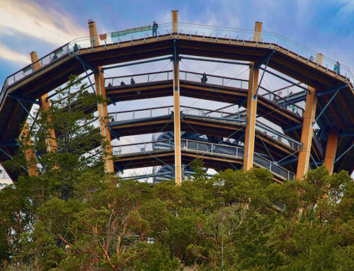
At the top of the Malahat drive is a new tourist attraction, the Malahat SkyWalk. The Malahat SkyWalk is a wheelchair and stroller-friendly, fully accessible 600 meter walk on a raised walkway. It winds through a beautiful forest leading to the Skywalk itself. This amazing wooden structure has gentle spiral ramp that takes you up 32 meters to a lookout offering spectacular views of Finlayson Arm, Saanich Peninsula, and on clear days, Mount Baker and the Coast Mountains in the distant background. And, you don’t have to walk back down, there is a Spiral Slide that will get you to the bottom in about 9 seconds! There is also gift shop and a cafe at the visitors center.
Access to the Malahat Skywalk is 4 km past the Shawnigan Lake turnoff, just past the summit lookout. If you are coming from Mill Bay you will not be able to turn left off the highway and you must pass the entrance sign and follow signs to the designated U Turn route.
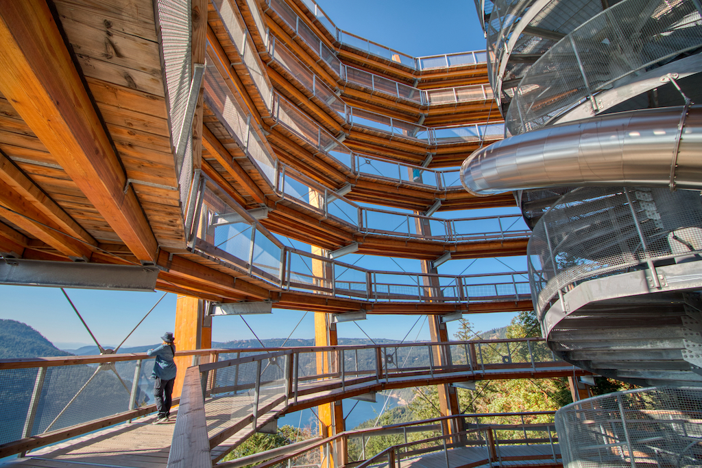
Walking the ramp in the Spiral Tower
Mill Bay to Duncan
From Mill Bay you will continue north on the Island Highway towards Duncan. You will pass through Cobble Hill where you could grab a coffee or do some shopping in some of the quirky stores at Whipple Tree Junction. Depending on the time you have and your inclination, you may want to drive the more scenic route through the back roads to Cowichan Bay. You can turn right on Kilmalu Rd on the far side of Mill Bay then the next left onto Telegraph Road and drive through beautiful pastoral farmlands and vineyards on a narrow gently winding road country road. Cowichan Bay is a small coastal community right on the water and is full of small gift shops, coffee shops and places to eat. From Cowichan Bay you will eventually rejoin the Island Highway and proceed into Duncan.
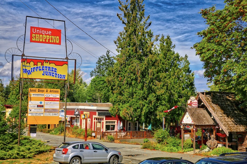
Whippletree Junction, Cobble Hill
Cowichan Bay

Cowichan Bay
Duncan to Port Renfrew
From the highway, Duncan doesn’t look like much, but get yourself into the old town centre and you will find a thriving community of shops and restaurants including one of our favourites, Craig Street Brew Pub. Duncan calls itself the “City of Totems” and has over 40 beautifully carved totems scattered all around the City, with a rich history behind each totem.
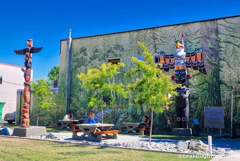
Duncan – City of Totems
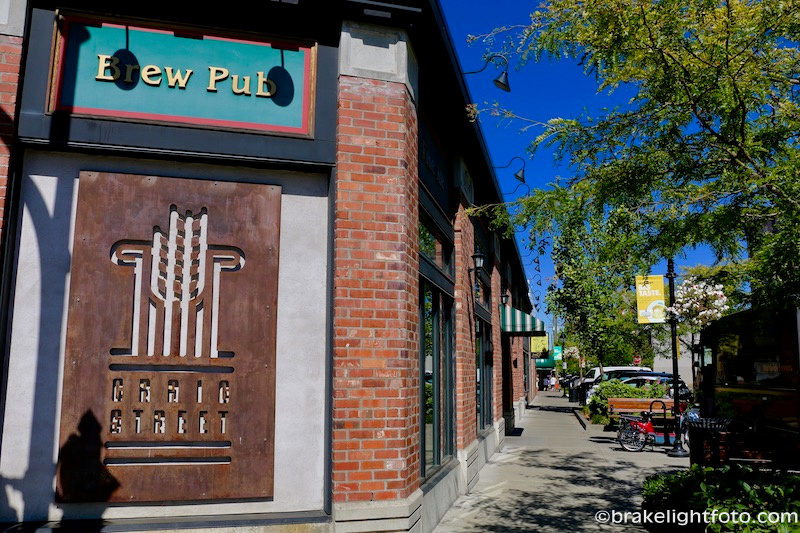
Craig St Brew Pub, Duncan
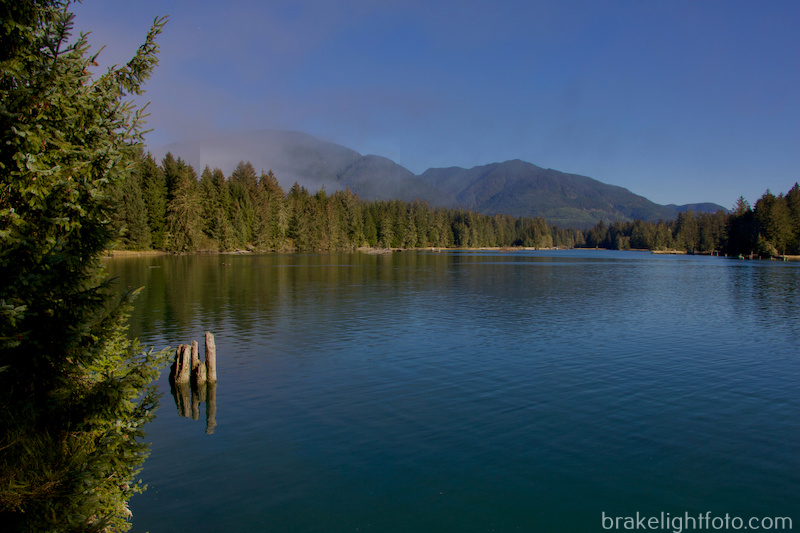
From Duncan you will turn west on the Cowichan Valley Highway which will take you up the Cowichan Valley towards Cowichan Lake. This idyllic community is situated on Cowichan Lake with the beautiful heritage Cowichan River flowing through the center of town. Cowichan Lake is one of the largest freshwater lakes on Vancouver Island. On the way there you can also stop at the Cowichan River Provincial park and hike some of the trails along this beautiful river and check out Skutz Falls and the beautiful Marie Canyon.
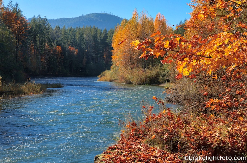
The Cowichan River
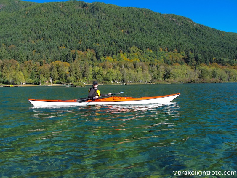
Kayaking on Lake Cowichan

Railway bridge, now a pedestrian bridge over the Cowichan River in Cowichan Lake
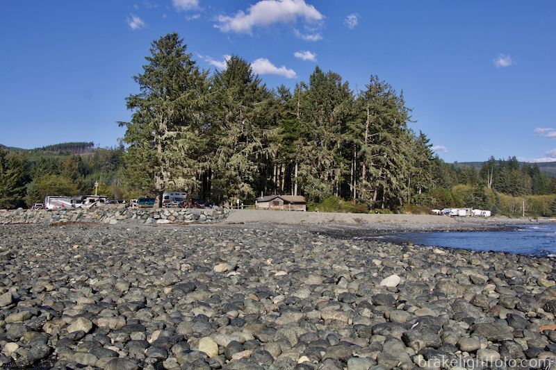
Passing through Cowichan Lake onto the South Shore Rd, you will come to Mesachie Lake which was a mill town from 1942 to 1968. Here you will turn south onto the Pacific Marine Rd which will take you over the mountains towards Port Renfrew. A little further down the South Shore Rd is Honeymoon Bay, another lumber mill town, the homes on the original townsite were built and completed by Western Forest Industries Mill in 1947.
The Pacific Marine Circle Route near Mesachie Lake
From Mesachie Lake you will start up the former logging road which winds over the mountains to Port Renfrew. This road is now paved making it a much less tedious and dusty drive than it used to be. As you come out on the other side you will pass by Fairy Lake Recreation site. A small bonsai tree growing on an old submerged log on the lake is said to be the most photographed tree in all of BC!
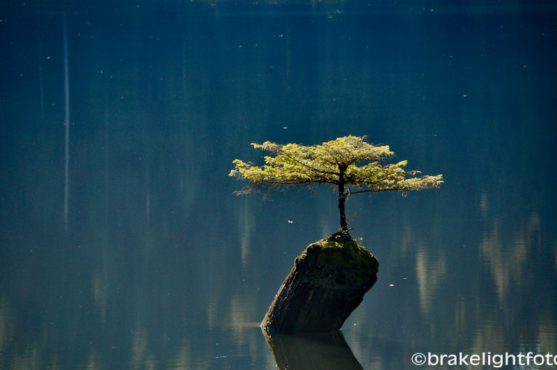
Tree growing out of a submerged log at Fairy Lake
You will continue west on Pacific Marine Rd from Fairy Lake and will eventually turn south on Deering Rd towards Port Renfrew. If you went straight ahead at this intersection you could proceed instead, towards Avatar Grove about 6 kms along gravel road. The Avatar Grove is a site of protected ‘old growth’ forest and home to “Canada’s Gnarliest Tree”. This magnificent forest was identified by Ancient Forest Alliance activists in December, 2009. It is located within the traditional territory of the Pacheedaht First Nation, and was recently declared off limits to logging through a new Old-Growth Management Area plan in February of 2012. There are a couple of beautiful, relatively short hikes through sections of the Avatar Grove on board walk trails and stairs.
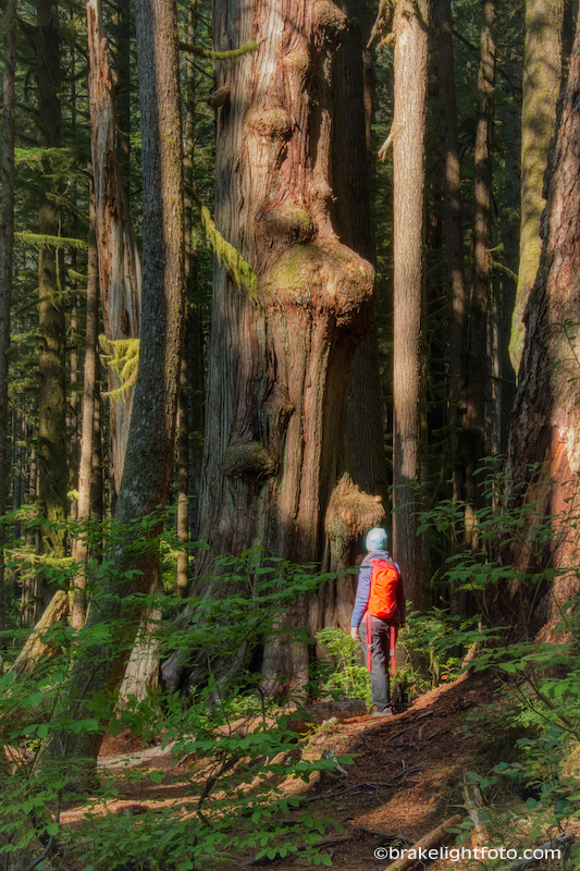
Avatar Grove
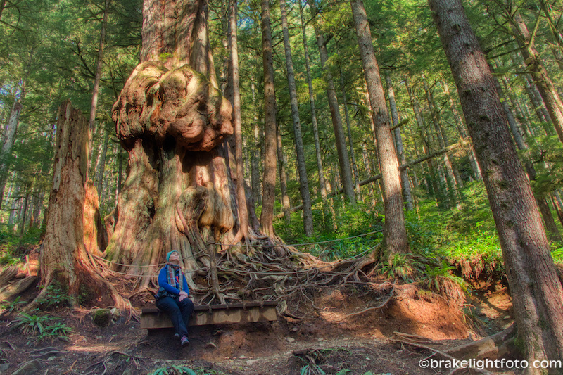
Avatar Grove – The Worlds Gnarliest Tree
Port Renfrew
Deering Rd takes you onto the San Juan River estuary at the mouth of Port San Juan with the gorgeous Pacheedaht Beach, running the length of the bay. At the north east end of the bay is the famous West Coast Trail head. Pacheedaht Beach is part of the Pacheedaht First Nations Lands. They allow camping on the beach and at their RV Park, but you will have to check in with them before accessing beach.
You will eventually cross the river into Port Renfrew. Port Renfrew is a very small community, but you will find accommodations, a couple of stores and restaurants, a pub and a gas station located here.
Pacheedaht Beach, Port Renfrew
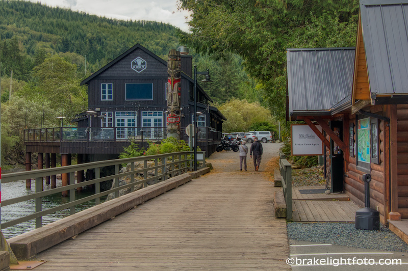
The Renfrew Pub & Government Dock, Port Renfrew
Port San Juan – Port Renfrew
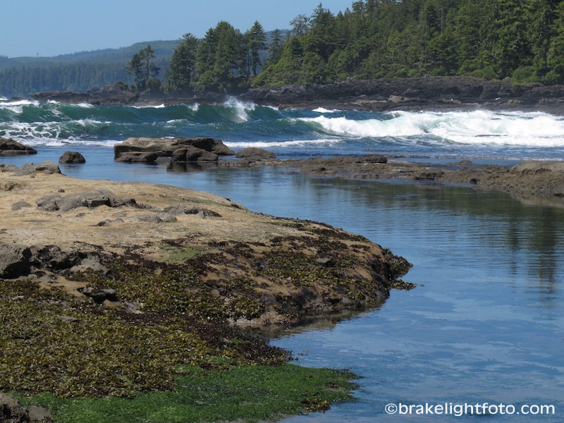
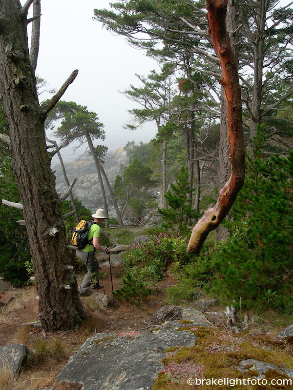
Just 3 1/2 km or so up along the coast from Port Renfrew is Botanical Beach, part of the Juan De Fuca Provincial Park which runs down the southwest coast to China Beach. A major feature of this park is the Juan de Fuca Marine Trail, a rugged wilderness hiking trail that stretches along 47 kilometres of wilderness coastline.
Botonical Beach
Botanical Beach itself is one of the most amazing places on the West Coast, particularly at low tide. With rich unique tidal pools carved out of the sandstone and granite outcroppings and a shoreline full of life, Botanical Beach offers one of the best opportunities to view intertidal marine creatures and plants on Vancouver Island. However, the impact of human activity on the intertidal area is of growing concern. When visiting please look in the tide pools only. Don’t touch, remove, or disturb any tide pool life, shells, plants, flowers, kelp, etc. – they are all part of a vulnerable ecosystem that Botanical Beach was established to protect. Even touching the water in a tide pool with sunscreen on your hands can create an “oil slick” that could kill the vulnerable creatures in this sensitive ecosystem. The area is a protected zone, so please take nothing but photographs from Botanical Beach.
If you are planning a trip to Botanical beach a low tide of 1.2 metres or less is best for viewing the tide pools. Use the Canadian Tide Tables “Port Renfrew” section. Remember to add one hour to the listed tidal times during March to November as Daylight Savings Time is in effect.
The Botanical Beach day-use area offers parking, pit toilets, visitor information and picnic areas.
Botanical Beach
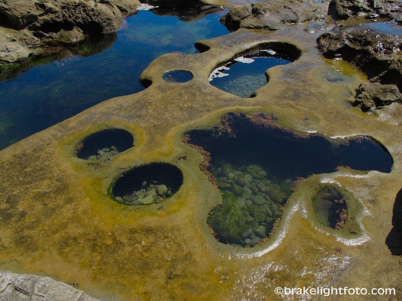
Tidal Pools at Botanical Beach
Port Renfrew to Jordan River
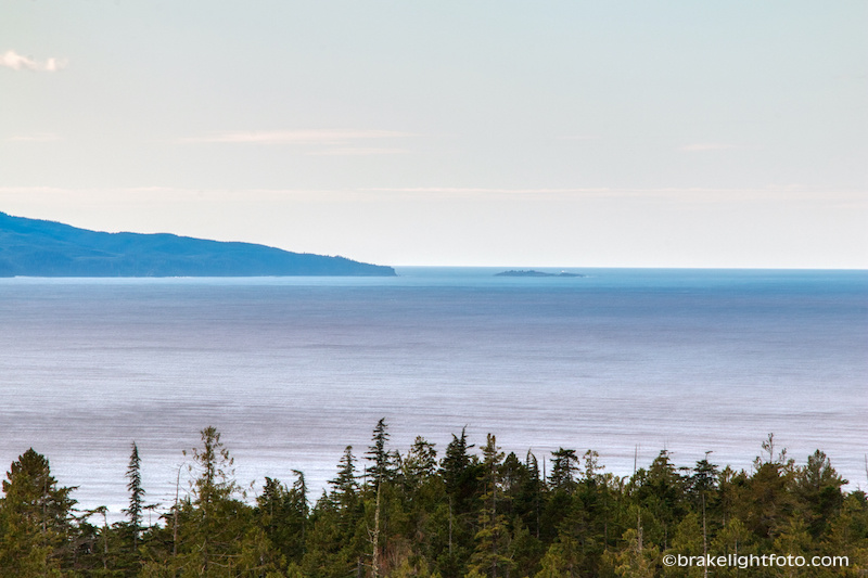
Once you get back on the West Coast Rd heading back towards Victoria, you will climb up onto the San Juan Ridge and will be rewarded with spectacular views across the Juan de Fuca Strait and the Olympic Peninsula. You will also pass by some amazing west coast beaches that have reasonably easy access; Sombreo Beach and China Beach. Sombreo is a fairly easy 1.5 km walk with wide well developed trails, while China Beach is about 2 km and takes about and hour round trip on a steeper narrower paths. Both trails get you down to beautiful cobble beaches with incredible views. Both Sombreo Beach and China Beach are part of Juan de Fuca Provincial Park.
A view of Cape Flattery from the West Coast Rd just outside of Port Renfrew
Sombreo Beach
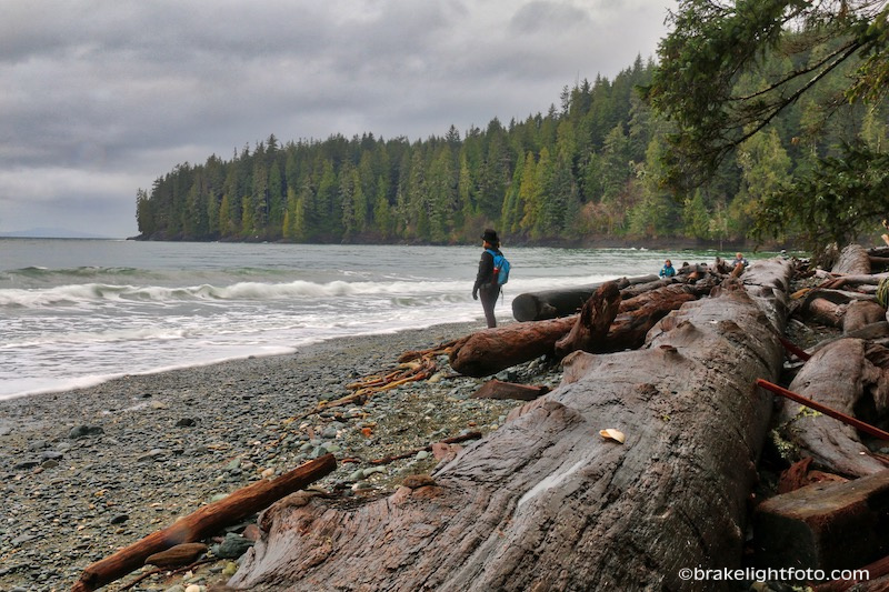
China Beach
Not far past China beach the road returns to the waters edge at Jordan River a very popular surfing destination for board surfers, SUP paddles and kayakers. As you come down the hill into Jordan River you will see the Cold Shoulder Cafe on your left. It is the only service you will find here. They have a delightful menu, that serves excellent coffee, made with locally roasted coffee beans, and a wide variety of fresh treats, soups and fresh sandwiches all made in house.
Jordan River is a local surfing meca. When the surfs up you will find board surfers, paddle boarders, kayakers and parasurfers riding the waves!
The Jordan River Mouth
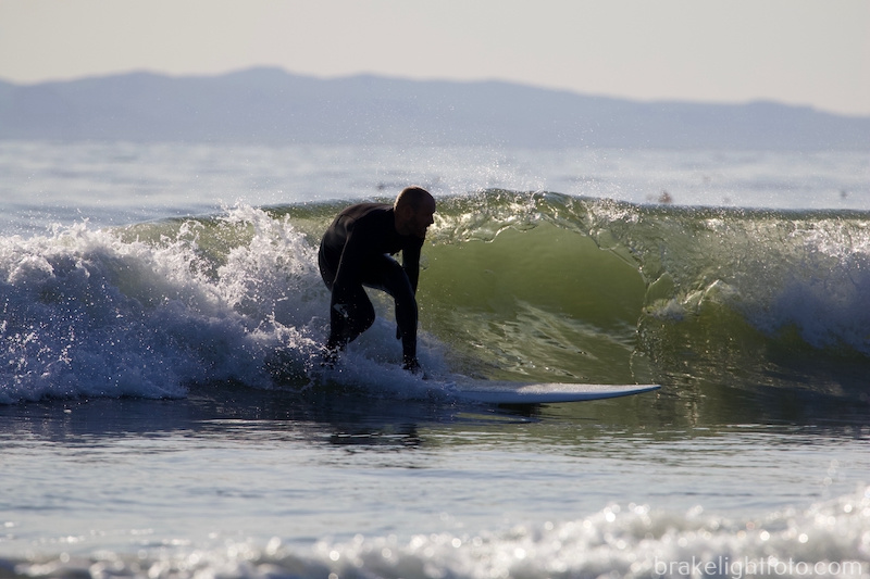
Surfing at Jordan River, BC
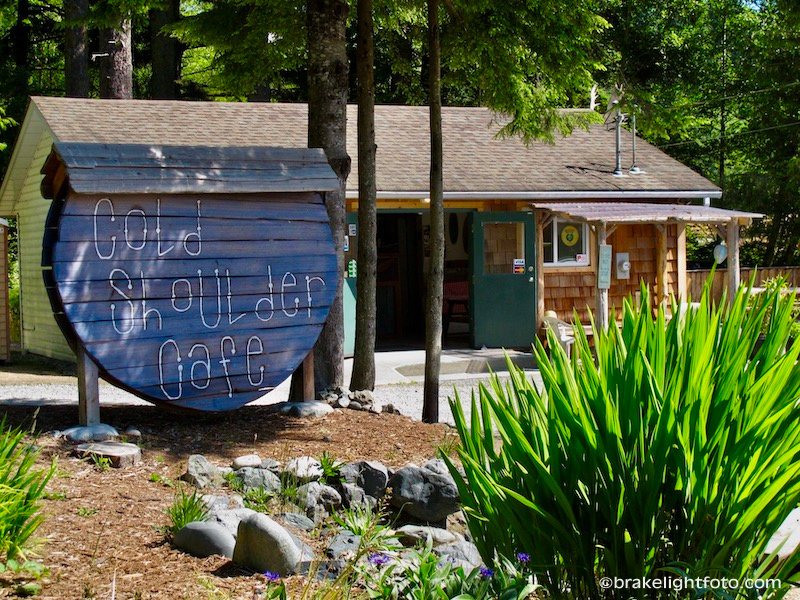
The Cold Shoulder Cafe, Jordan River
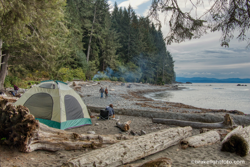
Jordan River was established as a logging camp in the late 19th century, and has Vancouver Island’s second hydroelectric power plant which was built in 1911. In 2017, BC Hydro bought out all of the properties of Jordan River and demolished the buildings because of fear of failure of the dam in the case of a large earth quake. Jordan River is now part of the CRD’s (Capital Region District) Jordan River Regional Park. There is parking, beach access and a campground here.
Jordan River Regional Park Campground
Just up the road from Jordan River is the parking area for Sandcut Beach also part of the Jordan River Regional Park and it is a short hike down to the water and yet another beautiful cobble beach. If you walk the beach to the left you will find Sandcut Waterfall pouring over a sandstone outcropping right onto the beach.
Sandcut Beach
Jordan River to Sooke
The next point of interest along the way is Point no Point, a resort located right on the coast with stunning ocean views. They have 25 cabins with kitchens and fireplaces. Their restaurant is a delight and if you do stay here they have a wonderful little hiking trail leading out to a rocky point with a couple of beautiful wood bridges crossing the ocean surge channels. Definitely worth a stop!!
Updates: As with many business, Point no Point is having problems with staff shortages. Please check Point no Point’s website for accurate, up to date information for their current offerings and restaurant hours prior to making the drive out.
The private trails at Point no Point are now only available to guests registered overnight at the resort.
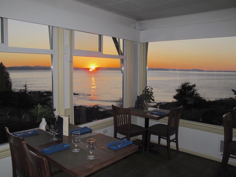
Point no Point Restaurant – Beautiful sunset views
Point no Point Resort walking trails
Just a few miles further along is French Beach Provincial Park with very easy beach access with a wide swath of green lawn fronting this sand and cobble beach. Facilities include a campground, picnic/day-use area, a sani-station, pit toilets and fresh water.
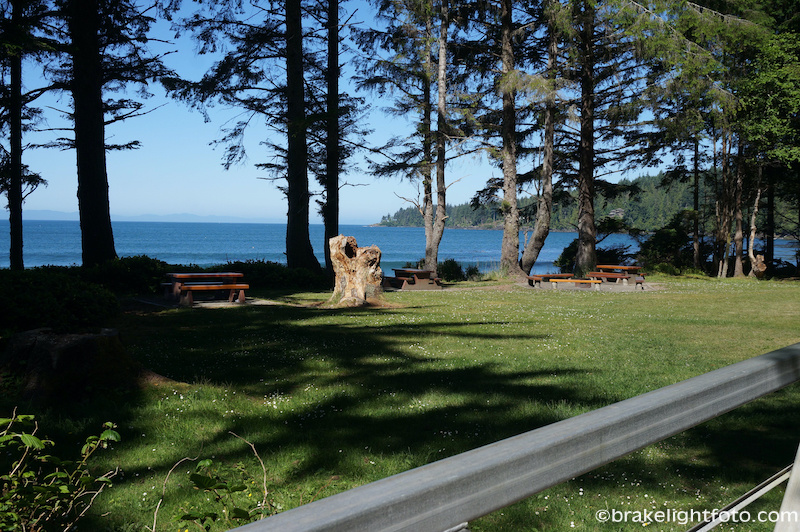
French Beach Provincial Park
Back on the road you will pass through the small community of Shirley. There is a restaurant, called Shirley Delicious, and if you drive down Shirley Road towards the coast you will come to the parking area for the historic Sheringham Point Lighthouse which began operation on Sept 30, 1912. It was automated in the 80’s and destaffed in 1989. However, due to the hard work and dedication of the Sheringham Point Lighthouse Preservation Society it has been restored to its former glory. Well worth checking out!
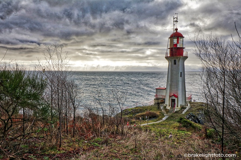
Sheringham Point Lighthouse
Just before Sooke you will pass Gordon’s Beach, another west coast cobble beach. There is public access to the beach, but there are also a lot of houses and cabins along the beach so it is not quite the pristine west coast experience you have seen at other beaches along the way. Right near here at 8750 W Coast Rd, you will also find the Tugwell Creek Honey Farm & Meadery with a tasting room, gift shop, and museum at their beautiful ocean view farm.
Once you get back to Sooke, you will be back in civilization. You will find all the amenities you could want here; gas, restaurants, fast food places, coffee shops, accommodation, shopping etc. Sooke is situated on Sooke Harbour, a large very sheltered bay on the coast.
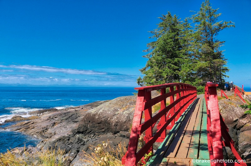
Points of interest include Whiffin Spit, at the end of Whiffin Spit road. The spit is a natural protrusion of sand and rock jutting out from Quimper Park, which forms a natural breakwater protecting the inner harbor. It is an easy, flat 1.25-kilometer walk leading out to the end where there is a small lighthouse.
Whiffin Spit, Sooke
Light Marker at the tip of Whiffin Spit
On the outskirts of Sooke just before you cross the Sooke River, you will pass the Sooke Region Museum and Visitor Centre, a community museum that explores the human and natural heritage of the region from Sooke to Port Renfrew. The museum is easily identified by the huge third-order Fresnel lens on display outside the museum. The lighthouse housing the lens was removed from Triangle Island on the northern tip of Vancouver Island, originally built in 1910, but the original lens disappeared while in storage after it was dismantled, so the Fresenel lens on display here is from the Estevan Point lighthouse. The museum also operates the local visitor information centre for the region, holds various special event during the year, has a gift shop with local arts & crafts, plus they can do special meals for pre-booked tour groups.
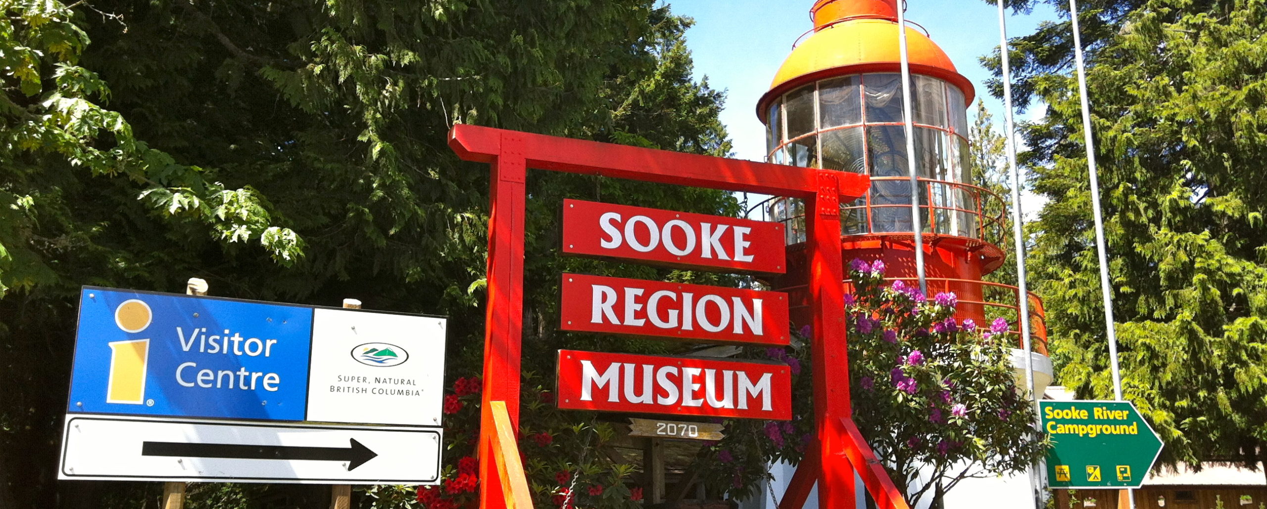
Sooke Regional Museum & Visitor Centre – photo courtesy Sooke Regional Museum
Just across the Sooke River Bridge on your left is the Sooke River Road which leads to Sooke Potholes Provincial Park. Here you will find access to the series of deep, polished rock pools and potholes carved naturally into the bedrock of the Sooke River. There are hiking trails along the river and access to the Galloping Goose trail which runs past the park here. There are picnic facilities and pit toilets located at the parking lot.
Just a little further up the road from the Provincial park parking area is the Sooke Potholes Regional Park where there is more parking, picnic facilities and a campground. You can swim, hike and bike the Galloping Goose Trail from here.
Sooke Potholes
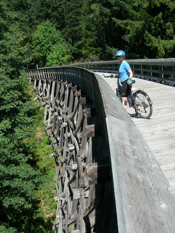
Tod Trestle one of the 2 trestles along the Galloping Goose trail that can be accessed from Sooke Potholes Park.
Sooke to Victoria
Leaving Sooke you will wind your way down West Coast Rd into Victoria completing the Pacific Marine Circle Route. If you want to follow more back roads and see a little more of the West Coast, turn right onto Gillespie Road about 6.5 kms from Sooke River Rd. This route will take you through some beautiful rainforest, past some rugged coastlines and into the tranquil farm lands of Metchosin. Follow Gillespie to East Sooke Rd where you will turn left.
As you follow East Sooke Rd you will pass signage for East Sooke Regional Park at the end of Belcher Rd. This parks offers some amazing hikes along the coast and incredible views of Juan de Fuca Strait and the Olympics. There are also some petroglyphs here.
Hiking East Sooke Park
East Sooke Rd will eventually become Rocky Point Rd which will lead you to Happy Valley Rd where you will turn right. In a short distance you will turn left onto Metchosin Rd right by the My-Chosin Cafe, a very popular restaurant with wonderful comfort food and a comfy country atmosphere. Follow Metchosin Road for approximately 6.7 kms to Lagoon Rd. On the way you will pass Witty’s Lagoon Regional Park, another gem with trails leading past Sitting Lady Falls down to a beautiful sandy beach.
View from the beach at Witty’s Lagoon Regional Park – Race Rocks Lighthouse in the Distance
Sitting Lady Falls in Witty’s Lagoon Regional Park
Lagoon Road will take you down to the Esquimalt Lagoon and the Coburg Peninsula, a narrow strip of land separating the Esquimalt Lagoon from the Juan De Fuca Strait. This is a popular destination for locals because of the sandy beach running its entire length and the bird life found in the lagoon. You will also see Hatley Castle on the hillside to your left and at the end of the spit you will see the historic Fisgard Lighthouse, built in 1860 and a part of the Fort Rodd Hill National Historic site. Once you cross the bridge at the end of the peninsula you will continue along until you reconnect with Sooke Road, where you will turn right and head back into Victoria either by Highway #1 or by following the Old Island Highway.
Esquimalt Lagoon
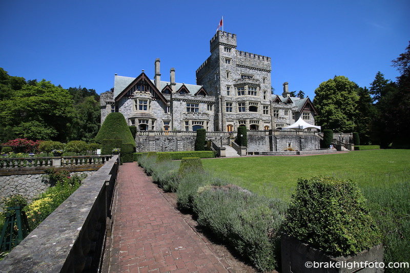
Hatley Castle
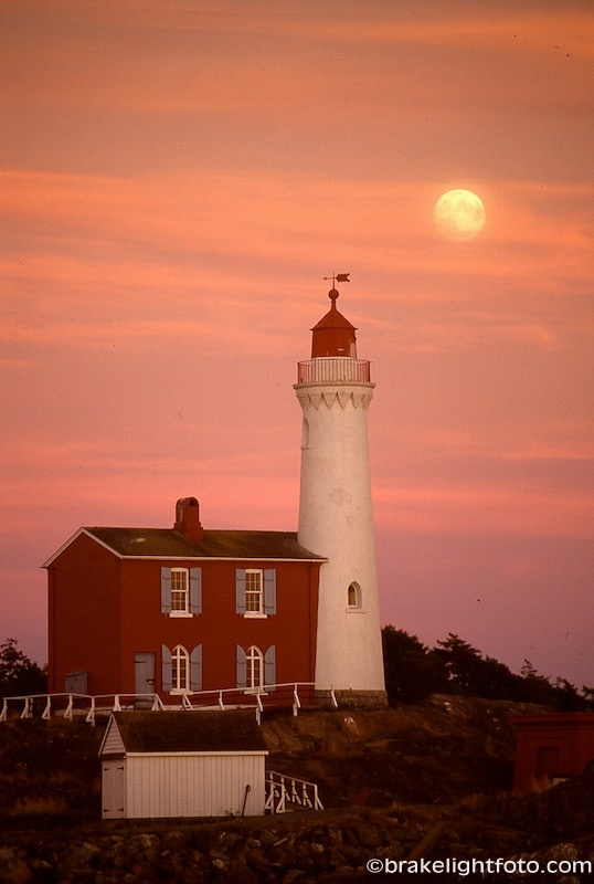
Fisgard Lighthouse
As you can see, there is a lot to see and do along the Pacific Marine Circle Route. If you only have a day you will have to pick and choose where to stop and how much time to spend there. Alternatively you may want to take a couple of days or more and book some accommodation or camp somewhere along the way.
beautiful photography.
Glad you enjoyed the photos! Thank you so much!!
Wonderful description of this route. I would like to do it in my older EV some day. Thanks!
Hi Rick, We’re so glad you enjoyed the post on the Pacific Marine Circle Route. Hopefully you will get out in that EV and make it around! Cheers!!
Hey Bruce, very detailed and informative. Thanks a lot for writing it up 🙂 It helped me a lot to plan my trip to Victoria, especially about the places I can visit outside of Victoria city.
Thanks so much Yashraj!! I’m so glad you enjoyed the post and found it helpful!! Cheers!